Lusk Creek
Lusk Creek Canyon (8.1 miles)
| Difficulty | I-III |
| Length | 8.1 mi |
| Avg Gradient | 20 fpm |
| Gauge | Lusk Creek Near Eddyville, Il |
| Flow Rate as of 18 minutes | 4 cfsbelow recommended |
| Reach Info Last Updated | April 22, 2025 |
Lusk Creek is the most well-known whitewater run in Southern Illinois. It is one of the most pristine waterways in the state and is up for consideration as a National Wild & Scenic River. It is currently protected as a National Forest Wilderness area and sections as an Ecological Area.
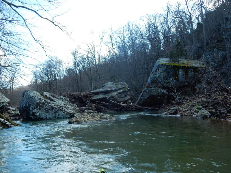
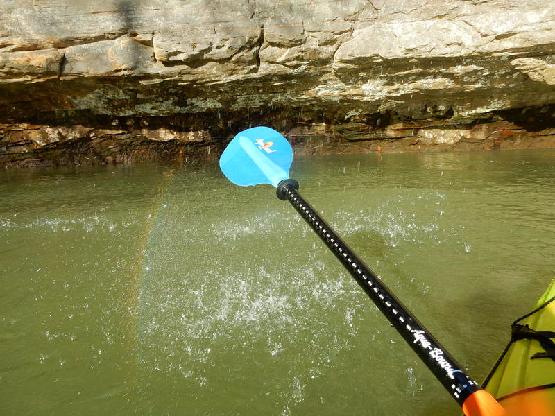
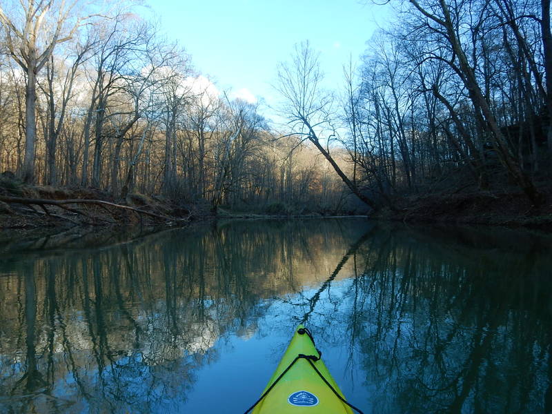
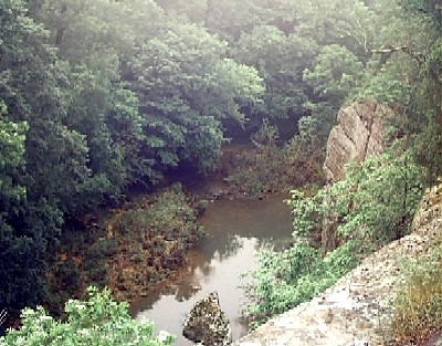
The creek starts out in woodland bottoms with relatively minor gradient but soon is surrounded by rocky hillsides and cliffs. The culmination of these cliffs come in Lusk Creek Canyon where the cliffs rise from water's edge to heights over one-hundred feet. After the canyon section, the cliffs recede and the creek is surrounded by forest for the final mile.
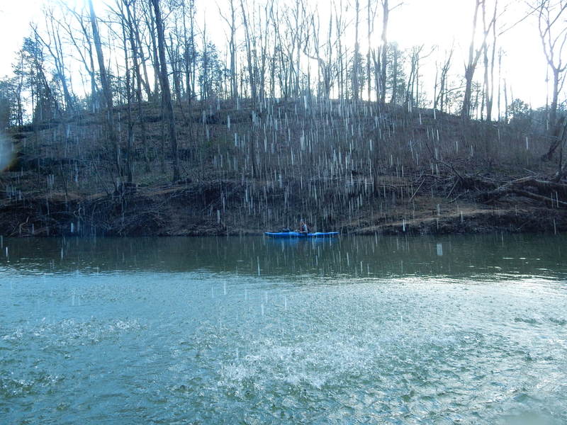
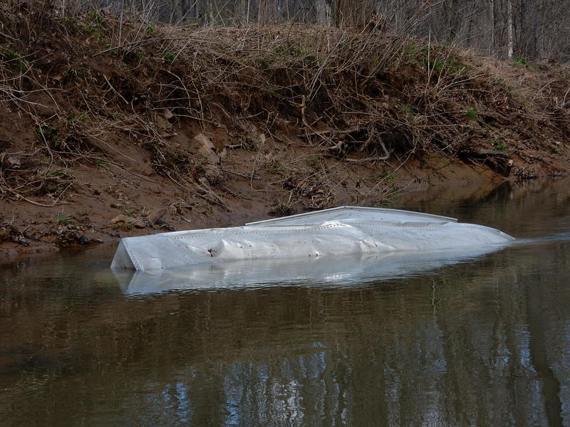
Rapids on this creek are Class II in nature (at normal, low-to-moderate levels). However, this is not a good beginner run. This creek flows through forests before entering the canyon. With regular flash flooding, this run is strewn with wood. Much of the run is boat scoutable but quick eddy turns or upstream ferrying may be essential to avoid strainers. Routes around these strainers can generally be found, but be alert! There is one mandatory portage at the end of the canyon where two large boulders seem to catch every log that has ever floated into them. The safest portage is through a small boulder garden on river right.
A fine video of an early season run is available: Lusk Creek Run 2/24/2016
(FWIW, looking at historical gauge data, it peaked at 1400 cfs 6AM that day, and by 1PM had dropped under 1000 cfs, and was low 700's by sunset at 5:45PM.)
For a look at a run of this river in flood, check out this footage reportedly at 3000 cfs! https://youtu.be/IgR_bqCBpIE
Editorial note: These boaters handled themselves quite well at these flows, but take careful note o
...
Stone Bottom Rd (AKA FR 1628) may appear to be a reasonable option to get near to the water (to then carry down a trail to put in). However, multiple reports suggest that almost any time the creek is boatable, this is likely to be rutted and impassable for anything but a 4WD truck (and highly recommended to have cable winches).
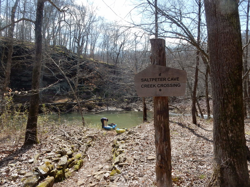
The recommended put-in is to park at the trailhead for 481/ Saltpeter Cave/ Natural Bridge, then hike 1.5 miles to the water.
Take-out for a 'short' trip would be at Ragan Road, an 'undeveloped' (dirt/mud) road off of Eddyville Blacktop Road. However, getting to the creek from the main road won't be easy (or even doable) for many vehicles at any time the river is boatable! So, just like the (hypothetical) Stone Bottom Road put-in, don't try this unless you all have 4WD trucks equipped with cable winches!
From Ragan Road, another 3.8 miles paddling (encountering a half-dozen more Class I-II spots) brings you to the truss bridge at Eddyville Blacktop Road. An improved landing and a large parking area make easy access/egress.
Apr 5, 2018
A word about the 'Directions' tab for this section of Lusk Creek. Under 'Directions Description' it reads 'It appears there is likely an alternate route to the put-in (which GoogleMaps fails to see). After passing through Eddyville (2.8 miles north of CR5/Eddyville Road crossing), turn right (East) onto New Home Road, go 0.6 mile to a slight jig-jog (passing Straight Street) to continue East onto Stone Bottoms Road for about a mile. This becomes a double-track (dirt road) which should lead to (or near) the river. (Assuming this is not marked/contested as private.)'
That's almost exactly correct. However, New Home Road connects to Hwy 145 (the main road in Eddyville) in two places. If you turn right onto it at the southern intersection, the shuttle is more scenic but the road less developed. The faster (and only slightly less direct) route is turning right onto it at the northern intersection. After passing Saddle Rd (left), you must turn LEFT onto Stone Bottom Rd; if you don't, you'll just end up back at Hwy 145 at the southern intersection. Stone Bottom Rd goes north then east. In wet conditions, it will be impassable by virtually vehicles that aren't 4WD trucks. (My AWD Subaru Outback could go only so far before it became a fool's errand.) Stone Bottom Rd will eventually lead to the creek, and the road is public.
Apr 4, 2018
After schlepping down Trail 481 since Stone Bottom Road was too washed out and rutted to take down to the ford crossing (even in a Subaru Outback), we left the car at the trailhead and hiked down to the creek. For reasons that defy comprehension, none of the trails in the Lusk Creek Wilderness area are measured out in miles or kilometers, either on the trail signs or the official map. (That said, the individual trails are posted well both in the wilderness area and the map, just not how long any given trail is...) Trail 481 is approximately 1.5 miles long, and it took us 1h 40m to get down to the water from Stone Bottom Rd. If the trail had snow, we could have just pulled our boats. Instead, we had to shoulder them in, which was arduous.