Taylor River
02. Taylor Park Reservoir to Almont(Taylor River Canyon)
Jul 22, 2025
In order to maintain its world famous trout fishery theTaylor has continuous release from the lake. It is almost always above 250 cfs which is plenty of water all the way from Lottis Creek to Almont. The commercial rafts operate all summer and boaters paddle it every day.
The information in the river description leads readers to believe that you need 300 cfs. That is inaccurate.
250 makes for a very nice day on the river.
Chris Kelly
Jul 29, 2018
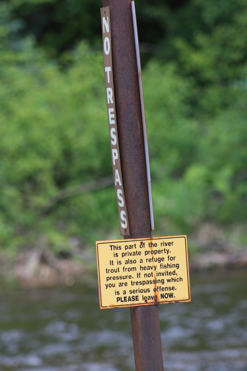
The River Description for the Taylor has some serious mistakes in its milestones and needs to be revised. The locals divide the Taylor into the Upper Taylor and Lower Taylor sections. The Upper Taylor is an 8 mile section that begins near Lottis Creek Campground and ends at Southbank R.A.P, just above a highway bridge that is just above Scenic River Tours upper shop (the lower one being in downtown Gunnison). The folks at Scenic were very cool in helping us set up our shuttle when my vehicle broke down. The locals call 'Todd's Slot' The Slot. IT IS NOT AT MILE 2. It is at mile 4, just above the commercial rafting put-in. I am a class III+ IK boater who ran the Upper Taylor two weekends ago in mid July. It is a beautiful gem of a class III river at around 250 cfs. After starting just down the road from Lottis Creek Campground, I immediately encountered a fun boulder garden warm-up before hitting the constricted series of fun drops known as Lottis Staircase. After some fun class II+ whitewater below through mile 2.5, I then entered into Diversion Jungle, a stretch of river modified with at least twenty boulder-constructed low-head dams to provide prime fly fishing for the customers of the private retreat owners of the banks encapsulating the river in that section. I expected to be confronted by property owners who do not understand boating easement law, but did not encounter any, even though I was clearly visible in my orange AIRE Force for over a mile. Upon exiting the private stretch, the natural bouldery drops of the river resumed. Then I hit The Slot. I was very fortunate to meet a local hard shell boater named Jay at this point, and I followed him through the final 3.9 mile section below The Slot. One can definitely see how The Slot becomes a IV/V in bigger water. I would call it a class III+ at 250 water when scouted, and a IV if not scouted. The Upper Taylor is very easy to scout from the road. The final 3.8 miles down to Southbank is a super-fun, nicely channelized class II/III run at low water with many continuous whitewater sections and numerous chutes and channels. It was a little scrapey in a few places at 250. Jay says his favorite level is 500 cfs, with 1000 being fun but short. There are a few logs to watch for, but all of them were old, river-worn and out of the channel. I did encounter one riverwide Douglas Fir above The Slot, but was able to easily step over it at river's edge at 250 cfs. After the take-out at Southbank (mile 8) the river flattens out and heads into Harmel's fishing resort. The owner says he will tolerate small parties of private boaters who are considerate to the anglers vacationing there. I looked at Harmel's section of river and didn't consider it worth bothering the fishermen. I say live and let live and don't bother with this section of the river. After that the river continues on into very unwelcoming private property for the next several river miles, with cables stretched across the river and rumors that the owners have made citizens arrests of any and all they consider trespassers. Again I say live and let live and leave these crusty old curmudgeons be. Below this hostile stretch is the put-in for the Lower Taylor, called Five Mile put in. From here, a very fun class II stretch is available all the way down to the highway take-out just below Three Rivers Resort and the Taylor/East River confluence. At this point the Legendary Gunnison River begins, and intermediate boaters can enjoy a long ride all the way to Gunnison Whitewater Park and beyond on safe levels of water. The whole Gunnison/Almont/Crested Butte area is a wonderful place for a whitewater vacation and so many other activities, and I would highly recommend it as an affordable family vacation or as an introduction to paddling for beginners at safe water levels.
Jul 9, 2018
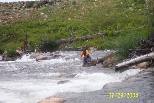
Paddler Zach Allen kayaking through the Cataracts on the Taylor Park run. June 16, 2007
Jun 30, 2018
The Taylor is a stunning river; beautiful alpine scenery, a boulder strewn course through the pines and lots of whitewater at different levels.
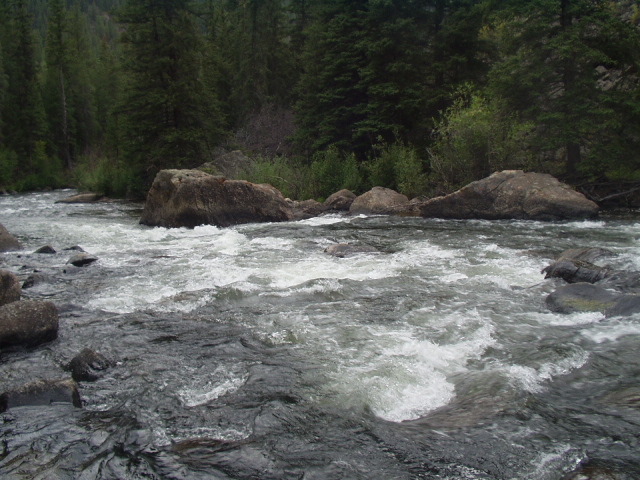
The great thing about the Taylor is that you can pick your poison. The top reasonably boatable section (there are serious access problems above here) begins at Lottus Creek Campground. The first rapid; Lottus Creek, appears immediately. It is a long class IV boulder garden. Next comes several miles of rock gardens alternating with more placid sections. Todd's Slot is the best known drop on the river and is a technical class IV- or IV rapid. It is a bit complex and has killed so take a look.
Below Todd's slot are miles of beautiful continous class III mountain water to the takeout by the Bridge right above a resort (can't remember the name).
Below this bridge to Almont the river steadly decreases in gradient until it is a placid class II stream where it meets the East River at Almont to form the Gunnison.
The top miles below Lottus Creek drop at about 80 fpm with the gradient steadly decreasing to 20 fpm at Almont.
I have been paddling it for about 15 years. My sense of the river in the early days was often: &;oh damn! If this gets any harder I am screwed; but it just never got above that point.
This is a trophy trout stream so it has constant releases all summer to maintain the fishery. Watch for wood, espicialy given the fast pace of the water. Most of my runs have involved at least one portage because of lumber in the river.
The Taylor is a superb Beginner (near Almont), intermediate (below Todd's slot) and advanced (from Lottus Creek) river and will have water when most everything else is dry. Chris Kelly
Mar 13, 2010
Taylor River Access
Aug 17, 2004
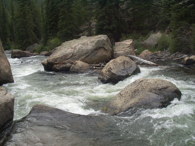
This is the entrance to Initiation.
This is the series of drops that makes up Lower Initiation. The big hole is just out of frame to the right.
This big hole makes up Middle Initiation. It gets bigger and meaner as the water rises.
This is looking downstream at the top of Slot, the big rocks in the other picture are just out of frame on the left.
Looking upstream at the rocks that make up Slot.
Some manky waves below Slot.
This is the biggest of the man made fishing dams in the Middle Taylor section. The proper line is through the last chute on the right. The drop is about four feet.
Looking up at the end of the Taylor River canyon.
Going over the rock on river right spins a raft really well.
Not the best picture, but the best line here is to go behind the big rock, then work back river left right after it and scoot through the goal posts.
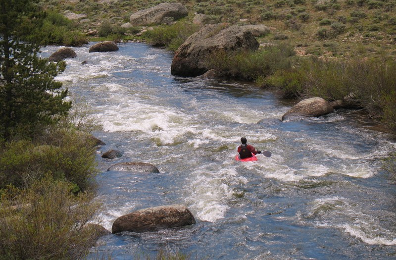
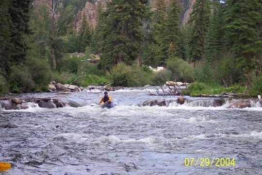
Jul 29, 2004
Ozark Society trip.........Not sure if there is anything wrong with the pic, but the BT general forum will be the judge of that..............
A little Duckie action.........Helmet, Pfd, Paddle (no leash), Well BT guys, don't guess anything wrong here unless it's the Duckie........:)
Open boat action on the Taylor......Despite all of the potential controversy over there at boatertalk.com that was the best line in the rapid......we scouted it and everything...........
Aug 17, 2003
This is a nice looking Class IV just above the put in for the commercial trips.
Jan 1, 1900
This is one of those Indian rock fish stopper things....Hope the Native American on BT don't get offended.....