Chestatee
3 - Copper Mine to Lumpkin County Park
| Difficulty | I-II(III) |
| Length | 28.9 mi |
| Avg Gradient | 10 fpm |
| Gauge | Chestatee River Near Dahlonega, Ga |
| Flow Rate as of 1 hour | 171 cfsbelow recommended |
| Reach Info Last Updated | July 5, 2020 |
Sources: S. Welander, B. Sehlinger and D. Otey, A Canoeing and Kayaking Guide to Georgia (2004); B. Sehlinger and D. Otey, Northern Georgia Canoeing (1980); Appalachian Outfitters.
The put-in can be either above or below Copper Mine rapid. For detailed information re. Copper Mine, see the Chestatee Section 2 page, AW Reach #3388.
Stay to the right of the island shortly below the rapid as the left channel is very shallow.
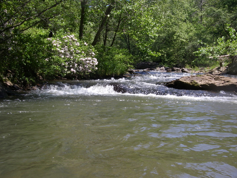
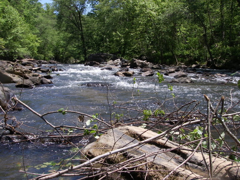
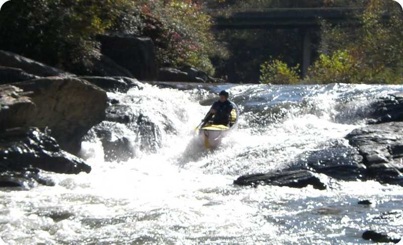
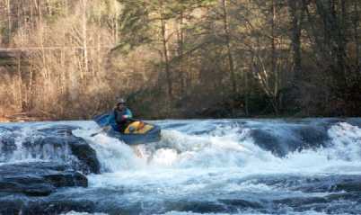
From Copper Mine to Highway 52, the gradient drops to 13 fpm. The scenery is still good, but the number of riverside residences is increasing. The section contains several Class II rapids (including Three Islands, The Rock Gates, Big Sky and Oh, THAT Rock) including Blasted Rock Rapid, named for the sharp, dynamite-blasted rocks that form it. The rocks were used to build a long-collapsed dam that stood at the start of the rapid. Shortly below Blasted Rock Rapid is a working granite quarry on river right. Shortly after the quarry is Highway 52, a short but steep alternate put-in/take-out.
Below Highway 52, the gradient decreases again and the river becomes slower with only Class I rapids. The scenery is still nice and consists of agricultural land and forest being rapidly replaced by development. Just before Highway 60, the river flows through Birch River, an upscale golf and residential development. Four holes require golfers to hit over the river so keep your eyes open for golfers preparing to hit and your ears open for cries of 'fore' aka 'duck').
Shortly before the Highway 60 bridge, a long, narrow island (with a par 3 hole on it) splits the river into a narrower left channel and a wider right channel. This split requires a strategic decision: the left channel is nearly blocked by a fallen tree that requires careful maneuvering through small gaps. The right channel has no such obstruction, but ffeds into the shallow right side of Gold Digger Shoals. At lower water levels, the right line t
...A three-level drop, the first of which is the most challenging. At normal water levels, the usual path is slightly to the left of rock located just to the right of midstream. SEE DETAILS AT CHESTATEE SECTION 2 (AW REACH #3388).
(For now, distance is map-based estimate.) The rapid is created by sharp, dynamite-blasted rocks that were used in a long-collapsed dam. The narrow island that divides the river can be run on either side, but be careful of deadfall on the left. Class II at moderate water levels, but more challenging with higher water.
Alternate put-in/take-out. Best access between the river and the dirt road is on river left about 100 yards before the bridge, just below the gauge building, but is steep enough to be a challenge.
An alternate put-in/take-out on Highway 60. Less traffic danger if you park and access the river from the large parking lot at the fruit stand, but ask permission if open. Gold Digger Shoals begins at the bridge and extends just around the turn to the right: the best line to avoid scraping or hanging up is near the left bank.
The outfitter's access is not that easy to see from the river: look for a set of wooden stairs on the river right bank.
An alternate put-in/take-out you can't miss: the river goes under two large bridges carrying Highway 400. Even if you're asleep, the traffic noise will wake you. The access is river right, under the first bridge.
The last reasonable take-out. Miss this one and you're in for a long paddle with no current. The take-out is river right, at the boat ramp.
Jun 5, 2011
My wife, daughter and I ran the section from Coppermine to Appalachian Outfitters Saturday 06-04-2011. The reported flow was 205 cfs and the gauge showed 1.1 feet. The run was extremely rocky. We scraped along the bottom of the river at nearly every fall, rapid, or ripple. While we never had to exit our boats to drag off rocks, it was a bit aggravating and did affect our ability to line up for runs. The options for running the various falls and shoals disappear at this low level an you often find yourself with but a single option, other than a portage, for passing a fall or rapid. This can create difficult and dangerous situations due to the lack of room to maneuver in a rapid or fall or to avoid sieves. If you plan to run this section at low levels be prepared to deal with shoals, sieves, and other obstructions that are under water at higher water levels.
Finally, the distance from the intersection of Hwy 9 and Hwy 52 to the bridge at coppermine is 1.8 to 1.9 miles and parking can be tricky as it is strictly roadside parking at the bridge.
Ran the section between Appalachian Outfitters and GA 400 on Saturday. River was nice and full, but lots of debris and at least two bank-t-bank downed trees. Some of the landmarks and beaches are hard to recognize with water up. Some of this section's 'rapids' are blown out at this water level; some new play spots appear in sections that are normally high and dry. All pretty straightforward though and easily navigated albeit fast water for the Chestatee.
May 19, 2007
Add another strainer to the list - May 19, 2007 in the pool just before Blasted Rock, river right. River left is open.
The strainer below Blasted rock is more of a hazard at this level 1.08 or lower as there is now a ledge that you have to go over, as higher level the little ledge is not visiable. The current want to pull you into the strainer.
May 12, 2007
Two new strainers (May 12, 2007) both are below Blasted Rock, first is jsut past the curve after Blasted rock and is 3/4 block from river right, Large Beech tree, easy to get about on the left. The other a spruce, below the church property beach area on river left, blocking 3/4, easy to get around on river right
Jan 11, 2006
New Streamkeeper: Rick Bellows, chestateer@yahoo.com.