Etowah
3 - Highway 9 to Castleberry Bridge. Etowah Falls Section. (Etowah Falls)
| Difficulty | II(IV) |
| Length | 7.2 mi |
| Avg Gradient | n/a |
| Permit | |
| Gauge | Etowah River at Ga 136, Near Landdrum, Ga |
| Flow Rate as of 1 hour | 161 cfsbelow recommended |
| Reach Info Last Updated | September 20, 2024 |
Sources: B. Sehlinger and D. Otey, Northern Georgia Canoeing (1980); S. Welander, B. Sehlinger and D. Otey, A Canoeing and Kayaking Guide to Georgia (2004); Appalachian Outfitters (706-864-7117).
This attractive run can be broken into two parts by putting in/taking out at Castleberry Bridge near the town of Auraria.
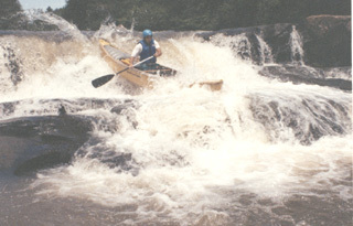
The 7-mile section above Castelberry Bridge includes most of the significant whitewater to be found on the Etowah. This section has wooded banks (which are giving way to residences) and several rock bluffs. The river has several Class I-II rapids and two rapids worthy of particular attention, Class II Chuck Shoals and Class IV Etowah Falls.
Chuck Shoals is a fairly straightforward slide that is normally run at an angle from left to the center chute. Scout from the rocks on the right as the banks are private property. Check for logs and debris that tend to accumulate at the top and bottom of the rapid.
Warning Drop, a two-foot ledge located shortly downriver of a large waterside residence on river left, serves as a warning for the upcoming Etowah Falls. Warning Drop can be run using any of several chutes, but the chutes on the left are clearer when the water is low. A long pool below Warning Drop, also known as Look Back Lake, provides ample opportunity to move right in preparation for portaging the Falls.
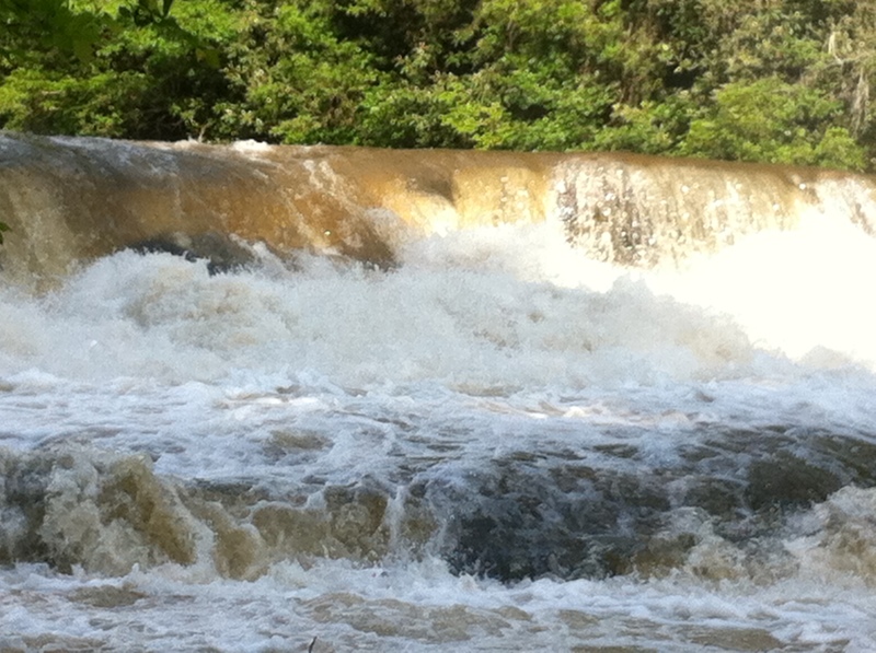
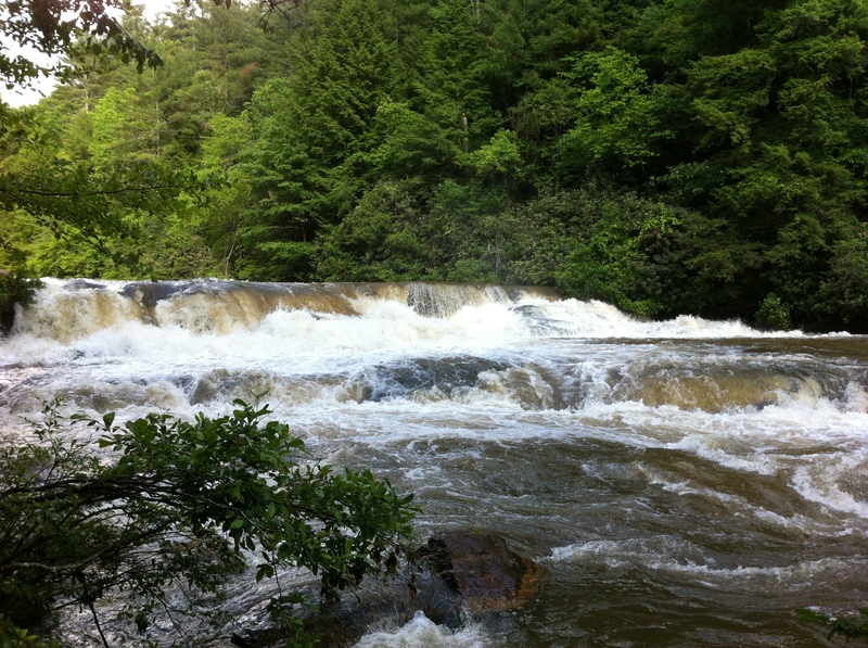
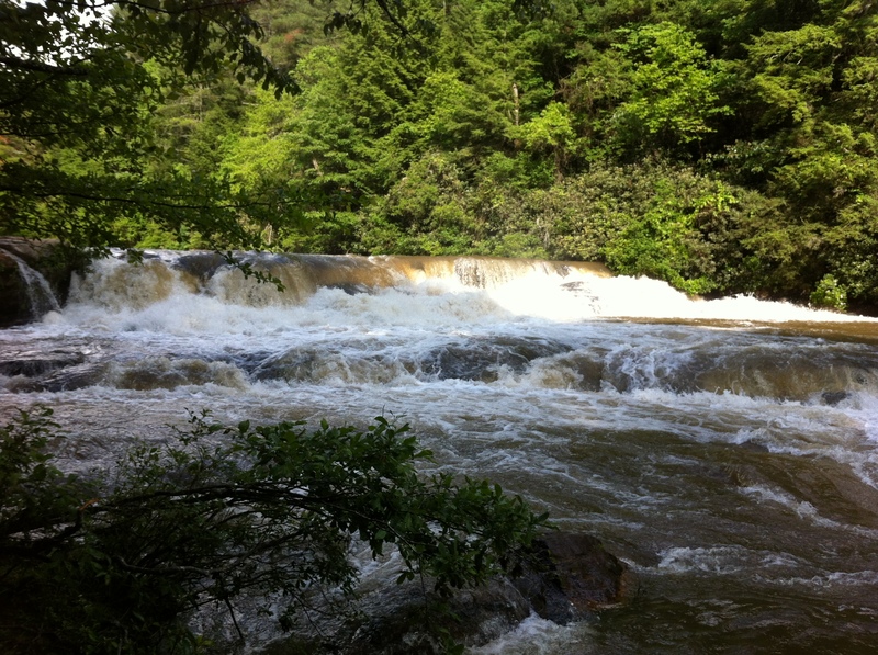
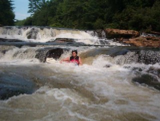
Etowah Falls, consisting of a 10+ foot ledge between two smaller drops, is just beyond the left turn at the end of Look Back Lake and presents a clear horizon line and a pronounced roar. The first small drop should not be run unless you also plan to run the main drop. Portage along the path on river right, beginning at or above the large rock: the land is owned by the family that operates Appalachian Outfitters, which permits boaters to use the path.
The main drop of Etowah Falls can be scouted from the high rocks on river right, also reached by the path: check for others playing in at the Lower Ledge/Rocky Road. I
...Put in under the south (river right) end of the bridge. Parking is available under the bridge.
A 100 foot long slide. Scout from the rocks on the right bank, noting any logs and debris. No good portage due to private property on both banks. Run from the left, angling towards the center chute.
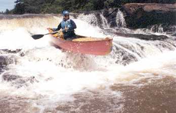
The lower level of the Falls is much less challenging and is often used as a playspot. (Be alert for boaters coming over the Falls.) There are several paths down the lower ledge.
A set of 3 ledges totalling about 12 feet, the Falls is easily picked out by the horizon line and the roar. Scout from the rocks on the right bank: check for boaters playing at the smaller ledge below. Runnable at higher water levels, usually by boofing just left of center. For the less experienced or at lower levels, the Falls can be portaged via a good path on river right.
A technical, read-and-run rock garden with many possible routes and a couple of small play spots. Cleanest route is to river right.
Another technical rapid with a small playspot or two. Cleanest route is on river right.
A thid techical rapid, this time with the cleanest line on river left. Move to the right below the rapid for take-out at Castleberry Bridge.
Take out on river right, at or shortly below the large rocks, for easiest walk to road. Alternative is to run small rapid and take out under bridge.
Dark, loud and wavy, the tunnel is an intimidating challenge for any first-timer. The upper half of the tunnel includes two waves sufficient to roll a boat: the lower half is generally flat water until the hole on the right at the tunnel exit. A rock on river right shortly below the exit can also be a hazard if you exit the tunnel out of control. If possible, safety dictates that you move downstream from the exit to the reconfluence with the main river in order to avoid danger from boats following through the tunnel.
Take out on either side of the bridge, depending largely on where vehicle is parked. The hill to the left is less difficult, but be careful of rocks at water's edge under the bridge.
May 26, 2021
Just to correct the 'Warning Drop' before Etowah Falls description to avoid confusion; the large house is on river right, not river left as stated. That's our house and we do see confused kayakers who ask if they are approaching Etowah Falls because all they see on river left is high forested hillsides.
May 30, 2020
Ran section below Castleberry Bridge 5-28-2020 with Ted Harrigan. There were many trees down nearly blocking the river. We maneuvered around most of them. We did have to portage 4 times around trees. We missed the side trip for the tunnel. Look for the left channel with two boulders at the entrance. We did see the exit. We did not go back up, so I have no idea if there was wood in the tunnel. Beautiful run.
Jun 30, 2019
Ran the lower (tunnel) section from Casselberry bridge to 136 today at around 230cfs. This was a good low level. Some of the rapids were a bit low, but had enough flow. I’d want a bit more flow for a Canoe, but was fine with kayaks. The word on the tunnel is the range is 150 to 400cfs. Any higher and you run out of room, any lower, you may want to just hike it. There were 4 deadfalls that needed portaging above the tunnel and none below. But some that would need to be portaged at lower levels.
Jul 10, 2014
Ran Hwy 9 to 136 on 7/6/2014 - 203cfs. Some significant deadfall between the mine tunnel and Hwy 136. The first was impassable - with help from members of our large group we were able to walk the boats underneath - not too deep up river of log but much deeper on the other side. The second one is a bit better to cross in small space on river right. At higher levels these could be better or a bit worse - either way use caution. The whole run took about 6 hours with a brief stop at the falls for a snack.
Jul 15, 2013
We ran the river this past weekend from Hwy 52 to Hwy 136. River was running at 6.30 feet and 500 cfs. Being our first ever river-kayaking trip, it was quite a challenge and we spent alot of time in the water. We had a great time and it took us around 6-7 hours to make it the whole way. Be cautious of a few strainers on the bottom half of the run, with one requiring a fairly long portage, right above the abandoned Mill. Can't wait to visit the river again!
Mar 19, 2012
This stretch of river is a real gem. A buddy of mine and I ran this yesterday from Hwy 9 to Castleberry bridge. The river was at 5.17 feet on the Dawsonville Guage and 275 cfs. It was a great run! One of the easiest put-ins and take-outs around. Very little scraping in our inflatable kayaks, and we opted to walk around the falls. We will be bringing our pre-teen children back for this section of river. Other than the falls, the rapids are large enough that they will have a blast without being too dangerous for them. There was one tree fully across the right side of the river a ways downstream of the falls. We pulled the boats across the log and kept going with no problem. This was a sweet spot for river flow and height, I dont' know that I'd want to go any lower than 5 feet and 250 cfs.