Etowah
3 - Highway 9 to Castleberry Bridge. Etowah Falls Section. (Etowah Falls)

May 26, 2021
Just to correct the 'Warning Drop' before Etowah Falls description to avoid confusion; the large house is on river right, not river left as stated. That's our house and we do see confused kayakers who ask if they are approaching Etowah Falls because all they see on river left is high forested hillsides.
May 30, 2020
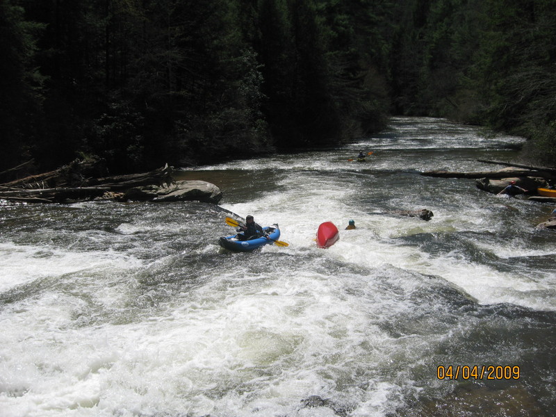
Ran section below Castleberry Bridge 5-28-2020 with Ted Harrigan. There were many trees down nearly blocking the river. We maneuvered around most of them. We did have to portage 4 times around trees. We missed the side trip for the tunnel. Look for the left channel with two boulders at the entrance. We did see the exit. We did not go back up, so I have no idea if there was wood in the tunnel. Beautiful run.
Jun 30, 2019
Ran the lower (tunnel) section from Casselberry bridge to 136 today at around 230cfs. This was a good low level. Some of the rapids were a bit low, but had enough flow. I’d want a bit more flow for a Canoe, but was fine with kayaks. The word on the tunnel is the range is 150 to 400cfs. Any higher and you run out of room, any lower, you may want to just hike it. There were 4 deadfalls that needed portaging above the tunnel and none below. But some that would need to be portaged at lower levels.
Jul 10, 2014
Ran Hwy 9 to 136 on 7/6/2014 - 203cfs. Some significant deadfall between the mine tunnel and Hwy 136. The first was impassable - with help from members of our large group we were able to walk the boats underneath - not too deep up river of log but much deeper on the other side. The second one is a bit better to cross in small space on river right. At higher levels these could be better or a bit worse - either way use caution. The whole run took about 6 hours with a brief stop at the falls for a snack.
Jul 22, 2013
At around 4.8 ft on the Dahlonega gauge, you should be able to see a small light at the far end of the mining tunnel from the tunnel entrance. At levels above that, the light will become blocked.
Jul 15, 2013
We ran the river this past weekend from Hwy 52 to Hwy 136. River was running at 6.30 feet and 500 cfs. Being our first ever river-kayaking trip, it was quite a challenge and we spent alot of time in the water. We had a great time and it took us around 6-7 hours to make it the whole way. Be cautious of a few strainers on the bottom half of the run, with one requiring a fairly long portage, right above the abandoned Mill. Can't wait to visit the river again!
Mar 19, 2012
This stretch of river is a real gem. A buddy of mine and I ran this yesterday from Hwy 9 to Castleberry bridge. The river was at 5.17 feet on the Dawsonville Guage and 275 cfs. It was a great run! One of the easiest put-ins and take-outs around. Very little scraping in our inflatable kayaks, and we opted to walk around the falls. We will be bringing our pre-teen children back for this section of river. Other than the falls, the rapids are large enough that they will have a blast without being too dangerous for them. There was one tree fully across the right side of the river a ways downstream of the falls. We pulled the boats across the log and kept going with no problem. This was a sweet spot for river flow and height, I dont' know that I'd want to go any lower than 5 feet and 250 cfs.
Nov 1, 2010
Tunnel Section below 100 cfs is not recommended. Ran it and it was extremely scrapy and not worth it.
Aug 20, 2010
I've made a you tube video that films most of the rapids...check out:
http://www.vimeo.com/10540640
I also did a video of GCA members going over chucks shoals:
http://www.youtube.com/watch?v=2-SJxdLGQ7Y
Aug 18, 2010
Have a queston ? Was gonna run this river tommrrow but talked to a guy and he said it was not a good run but on this site it is showing runnable anyone know ?
Oct 6, 2009
Ran the Etowah from Hwy 52 to Castleberry Bridge on 10/4/09 at 225 cfs. The strainer that was mentioned could be negotiated. You can wiggle underneath the tree on far river right. At a bit higher levels, it might be impassable and require portaging.
At 225, the Etowah was boney, but passable. I wouldn't go down it any lower then that.
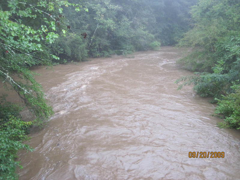
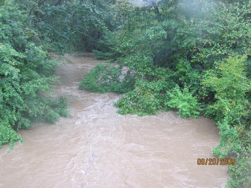
Sep 22, 2009
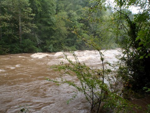
River up & fast. River was muddy, but alot of fun. With the recent flooding only one tree has fallen across the river. There is a large pine tree not to far from the Hwy 9 put-in located in the big sweeping turn as the river passes Pine Valley Rec Area. At 5.7 ft we floated over it, but it's going to be a problem as the river returns to normal levels.
Aug 30, 2009
Ran Hwy 9 to Castleberry Bridge on 8/28/09. Level on the GA9 gauge was 173cfs at 4.5 feet. I wouldn't run below 5 feet unless you enjoy getting out to walk your boat across the rocks. One riverwide strainer was navigable by going under on the left of the river. Took 3 and a half hours with several breaks, including stopping at the Falls for 20-30 minutes. Beautiful run, and enjoyable if the water levels are a little bit higher.
Jul 10, 2009
Ran this on 8/27/2008 from Hwy 52 to Castleberry. Online gauge said it was down to 200cfs by the time we hit the water at 5:30pm (after work). We finished by 8pm, before sundown. We were paddling in 9' kayaks, and at 200cfs. http://trail.motionbased.com/trail/activity/6624316
Feb 20, 2008
We ran the river yesterday from the Hwy 9 bridge to the hwy136 bridge. The flow was 140cfs and was ample flow for an nice float. The entrance to the tunnel was 90% blocked but with a little Kayak Limbo, we made it in. What a ride! Just before the Hwy 136 bridge, there is a tree down completely blocking the river. You must go over it to pass.
Jun 26, 2007
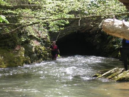
Floated the Etowah between Castleberry Bridge and GA 136 on 6/23/07. Haven't had much rain in this area for quite some time, but the river moved pretty good, only had a few times when my boat scrubbed and had to get out and walk a few feet. As said above, stay right at Sawyer's Island (I think it's the first island you come up on), the river to the left is completely blocked. I ran into two spots where a tree blocked the path of the river: one at the cave entrance and one not far above the 136 pull-out. Both are pretty easy to get over.
Even at low water levels, the waterflow thru the cave is very quick and deep enough. The ride thru the cave is not one to be missed, one of my best experiences on the river. But be prepared, it is very dark in there. A headlamp may not be a bad thing to have with you.
Jun 8, 2006
Ran from Castleberry Bridge to Highway 136 on 06/04/06, despite very low level (2.95 ft/90 cfs on the Dahlonega gauge, 4.28 ft./127 cfs on the Dawsonville gauge). Very bony, with several areas of shallows in the first half (above the tunnel) with no passable channel. A lot of deadfall, old and new, including several double and triple sets and several river-wide blockages. Stay right at Tom Sawyer's Island (about a mile below Castleberry Bridge) as left channel is totally blocked by deadfall. Also, some idiot ran a zip line across the river just above the tunnel - no problem at these low levels, and probably not at any reasonable level, but be aware of it. Finally, at low water, Class III-IV take-out carry at Highway 136 becomes a muddy (river right) or rocky (river left) Class IV+/V.
Jun 4, 2006
There is a fallen sycamore tree partially blocking the river left path through the last section of Castleberry Rapid. At current low water levels, it is not really a danger. At higher levels, it could be a risk to canoers. The river left channel can still be run, but stay to the right of that channel.
Apr 14, 2006
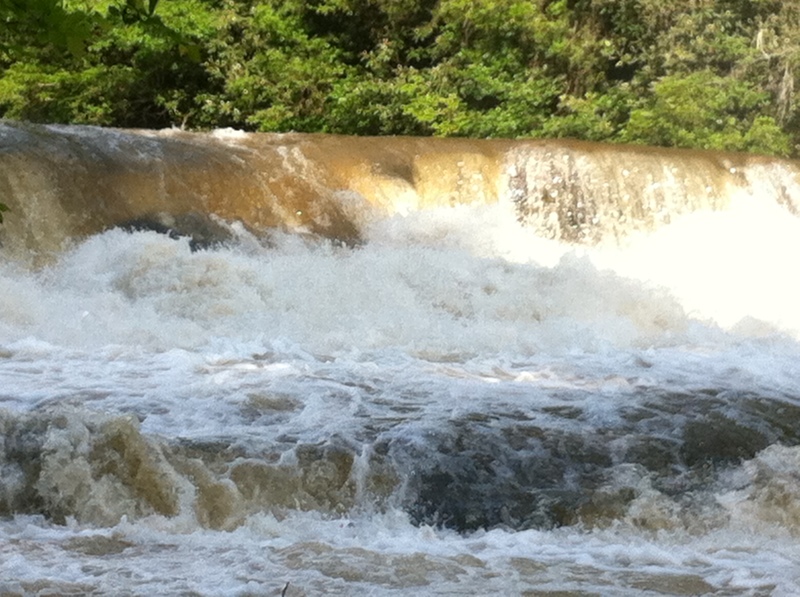
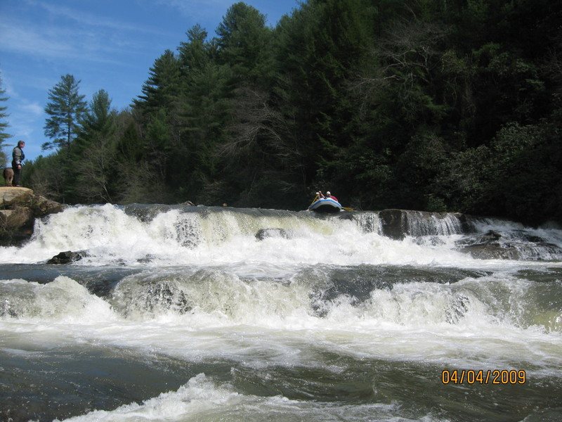
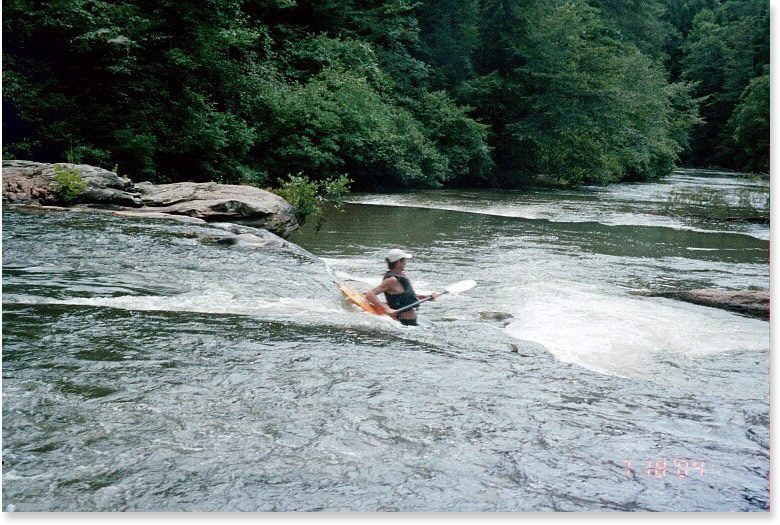
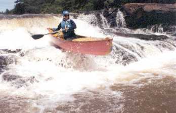
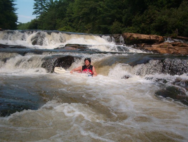
Two kayakers in our group ran the falls well below 300 cfs on 04/09/06. Good boof technique will prevent contact with rock but the line is not more than the width of a boat. The lip of the drop is just left of center.
Feb 2, 2006
Streamkeeper: Rick Bellows, chestateer@yahoo.com.
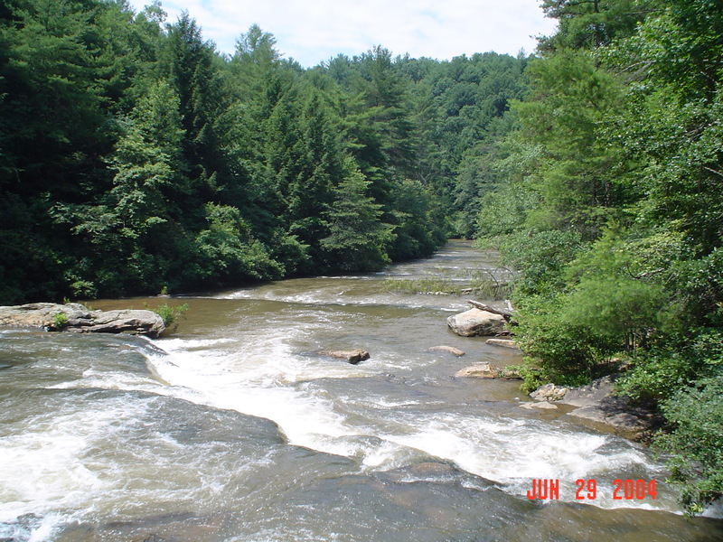
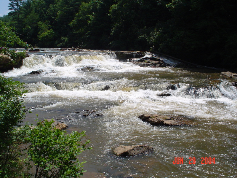
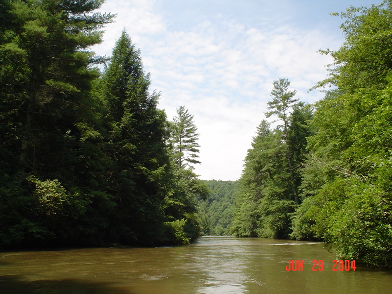
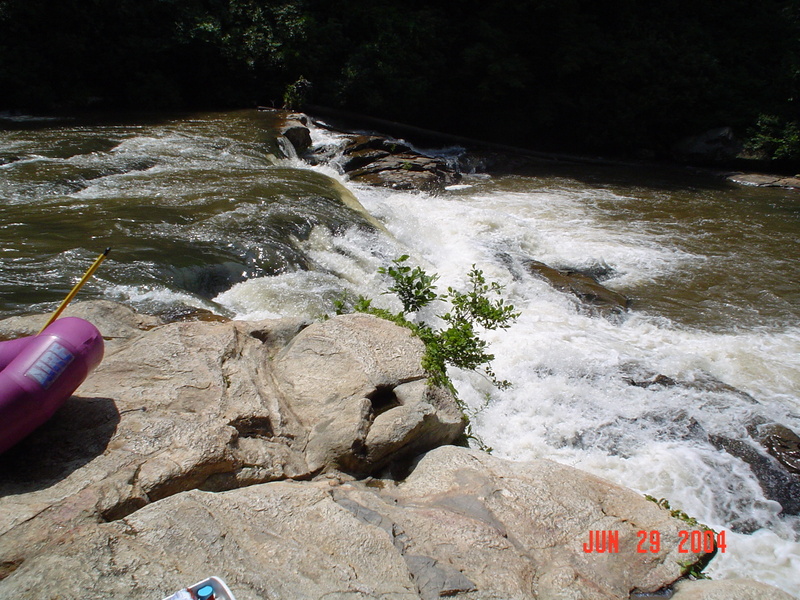
Jun 29, 2004
Approaching Etowah Falls in the distance, most people miss Surprise Ledge in the foreground. At higher levels this can lead to an untimely swim.
Jun 16, 2002
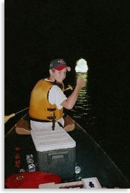
The tunnel is AWESOME. We have done it about 20 times. I suggest it to anyone that likes to canoe/kayak. It's almost a life-changing event.
Jan 1, 1900
Don't paddle in if you are claustrophobic or if you can't see daylight at the other end. As a matter of fact, don't paddle in here at all. You can sneak around the mountain.
You've just paddled a quarter mile thru a 10' diameter hole in the earth. Surprise! Now you have to immediately deal with dropping into moderate current coming in from the right. At least it's not dark anymore. Kayaking don't get much goofier.