Mill Creek
Robin Lane to West River Road (4 miles)
| Difficulty | I-II |
| Length | 4.1 mi |
| Avg Gradient | 8 fpm |
| Reach Info Last Updated | September 7, 2020 |
Quick Facts:
Location: Central Wisconsin, approximately 5 miles southwest from Stevens Point.
Shuttle Length: 4.8 miles. (See details in 'Directions' Tab.)
Put-in elevation is approximately 1068 '.
Take-out elevation is approximately 1036'.
Thus total elevation change is approximately 32'.
Information (lat, lng, elev, total drop, run length, shuttle length) adjusted and/or verified from best manual extrapolation of online data (via maps.google.com, distance measuring tool, and other resources). 2009.02.06
The resolution on Google Maps for this area is pretty good. Go to the 'Map' tab, click 'USGS Aerial' 'Satellite', double-click near the put-in, zoom in to the maximum resolution available (without losing image), and do a 'virtual walk' of this reach!
General Overview
Brendan Hammond offers (2009.04.22):
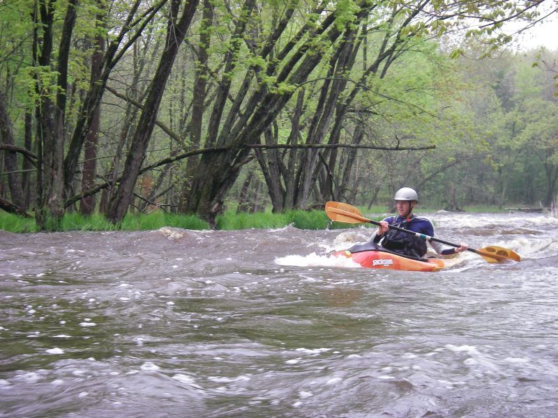
Mill Creek, west of Stevens Point, is a spring run for any Stevens Point/Marshfield area boaters. It consists of primarily 3 Class II rapids. One is almost a half mile long of fun continuous waves when high.
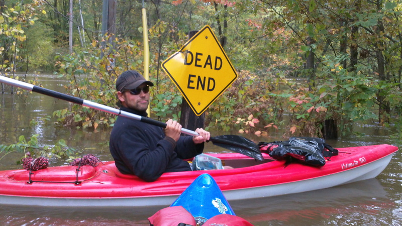
The put-in is Robin Lane and the takeout is at the confluence of the creek and the Wisconsin River at 'Rusty’s Backwater Saloon', where the creek is a backwater of the Wisconsin River. There is a boat landing where an old bridge was removed, so it’s at the end of Rusty’s driveway. I believe the road is West River Road.
A slightly longer run is possible, putting in at County Highway C, and reportedly picking up one additional rapids.
Thanks, Brendan!

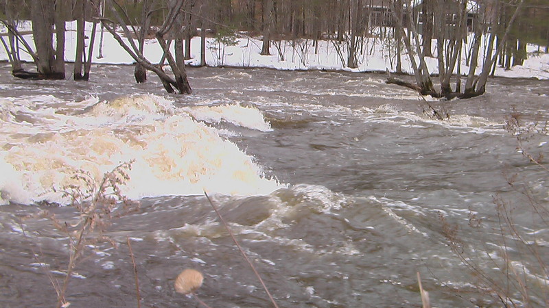
The main area of drop on this run occurs just past County Highway PP, as the river drops nearly 30 feet in roughly the next half mile.
May 6, 2012
Easy surf wave
Mar 11, 2012
did a short run (just the 1/2 mile below PP) at ~540cfs and it was a clean run with a few play waves midway down. I would described the location as when the river starts to turns left toward the road and before it splits around a small island.
Apr 5, 2011
water was 38F and the flow was good. Wisconsin backwaters were still ice jammed so we took out at the linwood town hall. Some of the smaller waves washed out at this level. There are also few eddies below PP.
Oct 24, 2010
Ran this during the week of the Sept flood at 6'(1350cfs) . A good level with no real danger. Seen it at 8' (2200cfs) and there is more danger as the water is moving through the floodplain with some velocity. Probably not an issue for intermediate boaters, the run from PP down is roadside and easily scouted to assess the risk. The upper rapid has to be good fun with big waves and holes at 7' (3300cfs) and higher. The minimum could be 4' (only ~250cfs) but 5' (700cfs) is much better.
Sep 26, 2010
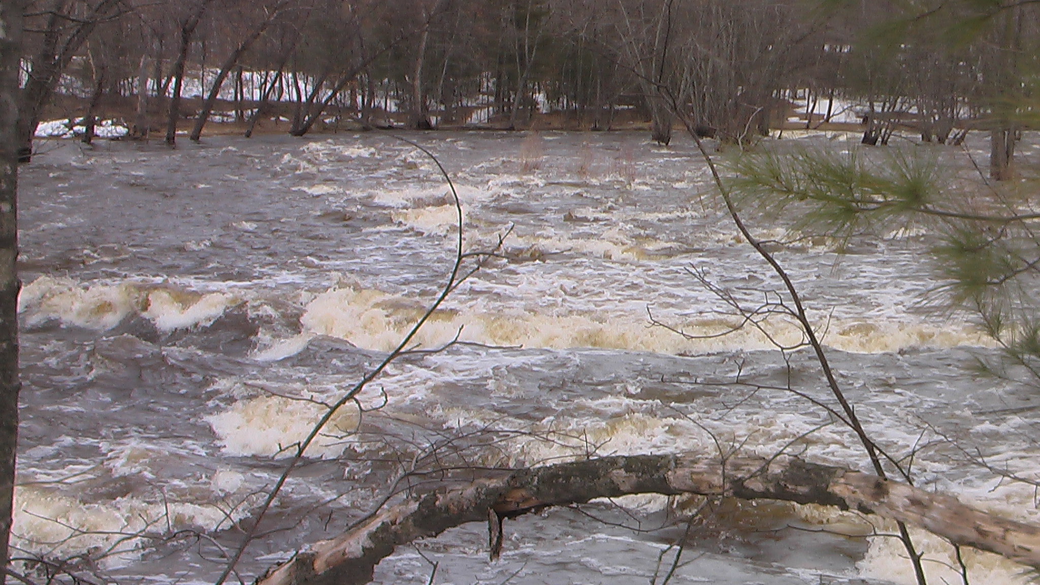
River was still completely flooded when reading 7.07 feet on the USGS gage, viewed from the put in at Robin lane). Water was over the banks and trees were half submerged in water. The river would have been incredibly dangerous to run at this level due to debris and high risk of strainers where the river constricts downstream. I was told by those living close to the river that a bridge down stream was under water. Obviously, this creates a dangerous situation for boaters. I would not recc trying this river (without careful scouting from land) if the USGS gage 05400513 is higher than 5 feet.
Sep 24, 2010
this is the dead end rd of robin ln we mostly start at hwy c or even hwy m
Aug 18, 2010
At levels of 3.65ft and up on the USGS gage, I've run this river without too much problem in a kayak (Dagger Approach 10). You will scrape rocks and may get hung up occasionally, but with a little navigation skill, you can run this river at 4ft and up without worrying about damaging your boat.
Apr 3, 2010
USGS has just recently installed a real-time gauge at the Hwy PP bridge where the painted gauge exists. A rating curve has not been developed and the correlation to the bridge gauge is uncertain. The site number is 05400718
Apr 3, 2008
quarter mile down stream of County Hwy PP
small play hole