Catoctin Creek
US 40 (Doubs Meadow Park) to Potomac River
| Difficulty | I-II |
| Length | 26 mi |
| Avg Gradient | 12 fpm |
| Gauge | Catoctin Creek Near Middletown, Md |
| Flow Rate as of 1 hour | 1.59 ftbelow recommended |
| Reach Info Last Updated | June 5, 2025 |
Ed Evangelidi testifies: Gertler has this same trip at roughly 25 miles. There is a gauge at Rte. 17 and the dam there and riffles below should have sufficient water to considering putting in there. Should be cleanly runnable without scraping to consider putting on further upstream. The park service is considering discontinuing access to the Potomac River takeout at Lander, but it is still open at this time.
access points from John Duke
any questions e mail me!
Mile 0.0--Rt. 40 bridge: not recommended, use the park on river right (Doub's Meadow Park) just downstream
Mile 1.3--Brethern Church road: room for 3 or 4 cars with a gravy put-in, this is a low-water bridge and must be carried
mile 3.7--Rt. 17 bridge just south of myersville: not recommended, very little parking and farm fences on all sides.
Mile 6.7--Station road bridge: not recommended
Mile 6.8 to 7.1--Shank road follows on river right with nice access pull-offs.
Mile 9.8--Alt. Rt. 40 bridge: not recommended
mile 11.3 -- bidle road bridge: not recommended
Mile 12.3--Rt. 17 bridge just south of middletown: excellent access just downstream of the bridge at the USGS. gauge
Mile 14.3--Bennies hill rd.: OK for a couple of cars
Mile 16.0--Sumantown road bridge: Park property on downstream river left with OK parking.
Mile 16.2--Catoctin Creek Park & Nature Center park property on river right with parking a short walk from the creek.
Mile 18.7--Poffenberger road bridges and follows the creek for 1/2 mile but is posted!
Mile 20.8--Rt. 383 bridge: not recommended
Mile 22.4--Rt.180 bridge: nice parking on downstream left
Mile 24.7--Rt.464 bridge: Ausherman road hangs an upstream river right with decent access
Mile 28.4--Confluence with the MIGHTY Potomac river
Mile 28.8--C&O canal at Lander: Excellent boat ramp on the Potomac
...Put In - Doubs Meadow Park - off MD17 near US 40.
Take Out - Potomac River at Lander Rd.
Mar 3, 2024
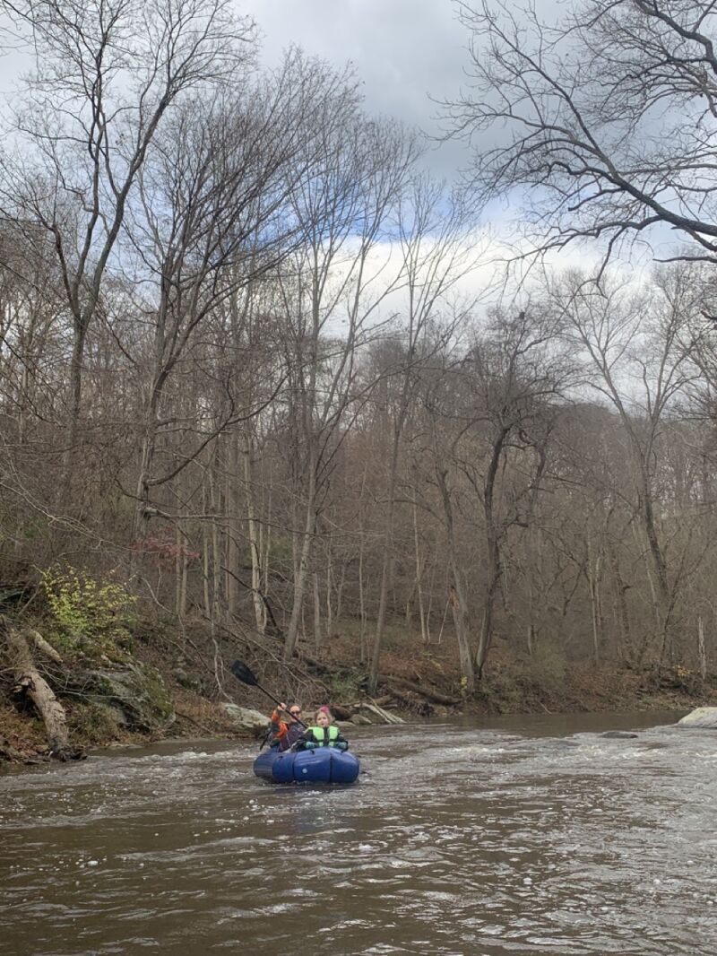
Packrafted from Catoctin Nature Park to the Catoctin Acqueduct; total run time just shy of three hours. The water level was good throughout, with only a few brushes of rocks along the way, and only one spot (next to / under the Point of Rocks Road / Rt. 464 bridge) where it was unavoidable. All Class 1 rapids, some nice and bumpy / splashy but none challenging. No strainers across the entire creek _except_ at Catoctin Acqueduct, which was completely blocked by trees, branches, and debris; had to take out between the acqueduct and the train tracks. Lots of Bald Eagles, Canada Geese, Belted Kingfishers, and other critters throughout.
(This was a bikerafting trip, riding from Brunswick to the park ~10mi, then ~10mi paddling, and ~5mi ride on the C&O back to Brunswick.)
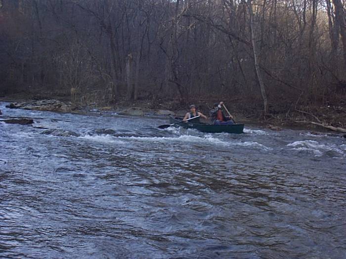
Nov 12, 2022
This trip from the Highway 17 bridge (next to the USGS gage) to Catoctin Nature park was peaceful and uneventful. Class I all the way...maybe Class I bumpiness when aiming for every wave and drop?..and at the gage height of 2.25-2.3 during the trip, was right at the limit of what was runnable. Lots of Belted Kingfishers and other birds, and beaver made an appearance too. Easy hike out at Catoctin Nature Park, then biked back, mostly on back roads, to the put-in.