Catoctin Creek
US 40 (Doubs Meadow Park) to Potomac River
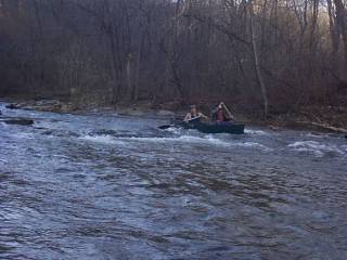
As of Saturday, March 20, 2010, at ~2.54 on the Middletown gauge, there were 4 river wide strainers between Brethren Church and the USGS gauge takeout. At this level, 2 were successfully navigated, one required a real portage, and one required exiting then lifting boats over the strainer. Obviously changes in flows may change this.
If you're using Google maps, the Brethren Church Road access point is essentially at '3400 Brethren Church Road, Myersville, MD'. And the USGS gauge access point is essentially at '7200 Burkittsville Road, Middletown, MD'.
Not to mention that there was an electric fence wire across the entire creek! Downstream of the Alt. US 40 bridge and just upstream of the water treatment plant (and the Bidle Road bridge).
At least I *think* that's where it was...
No articles