Octoraro Creek
3. New Bridge Road to Moore Road, Richardsmere(Lower Octoraro)
| Difficulty | II |
| Length | 6.2 mi |
| Avg Gradient | 15 fpm |
| Gauge | Octoraro Creek Near Richardsmere, Md |
| Flow Rate as of 1 hour | 51 cfsbelow recommended |
| Reach Info Last Updated | September 25, 2021 |
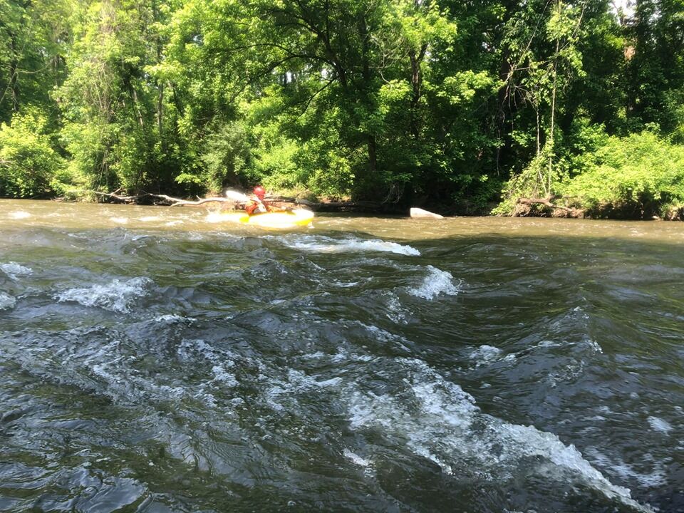
Nice little section with some trashy and scenic surroundings. This is a kind of a forgotten corner of MD, but it's worth visiting and the river is worth running. It's kind of like the Brandywine without any dams.
The first 2.6 miles are pretty mellow, but things start to get going after the Rt. 1 bridge. Fun Class II rapids result as the Octoraro (which is Native American for 'rushing waters') drops down to the Susquehanna below Conowingo Dam. Take out on a small side road before the Rt. 222 bridge in the historic mill town of Richardsmere.
The Upper Octoraro is categorized as a Pennsylvania stream.

On weekends, it seems to be OK to park in the bus turnaround area on the downstream River right side of the bridge. But there's only room for 2 or 3 cars here, so try to leave as few cars here as possible. On weekdays, the bus turnaround is needed for school buses to turn around so however inviting it might seem, this area must be kept clear. Look around, there may be other options.
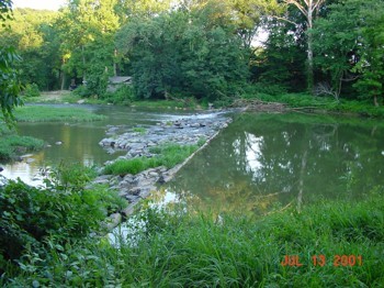
At this location the New River Ranch Dam was removed in 2005. The Dam removal left a Delta that created a river wide shoal runnable down to about 340 cfs on the Richardsmere Gauge, roughly river center. Below 340 cfs you will hit some rocks and have some hand walking here.
Not a rapid or an access point - just a landmark. The river picks up some below the bridge.
Under the second set of power lines there is a ledge. At lower water there is a line from river left to center. At higher water there's more options and at even higher water it becomes a wave.
At or above 500 cfs (or so), this is a class III rapid, as the current slams into a rock on river right. In order to avoid this hazard, the paddler needs to set left angle and drive to the left. At lower water (400 cfs or lower), this is an easier Class II move, still center to left.
Take out on Moore Road on River right above the US 222 bridge in the historic mill town of Richardsmere.
If you have a large group, there is more parking at the Ballfield at River left just below the US 222 bridge
Aug 23, 2018
Ran 8/21/18 @ 3.6 ft on gauge. No portages required, no stream-wide strainers, and only one shallow spot. Fun riffles and boulder gardens with a single 1 ft drop about half way. Scenery is great, very little hints of civilization. It only took us about 1.5 hours to travel the 6 miles.
Jun 5, 2017
Gauge switched to Octoraro at Richardsmere
Aug 21, 2011
Could someone please explain why the gauge used for this run is 'Brandywine Creek at Chadds Ford, PA.' I looked on Google earth but never found a any connection to the Octoraro Creek. There is a gauge found on the USGS site for Octoraro Creek:
http://waterdata.usgs.gov/md/nwis/uv/site\_no=01578475&PARAmeter\_cd=00065,00060,62619,62620,00062,00054
Shouldn't we use this one instead since it is on Octoraro Creek?
May 17, 2007
The New River Ranch Dam was removed in 2005.
The following article talks about the removal and has pictures: http://www.bayjournal.com/article.cfm?article=2652. The Dam got it's name from the 'New River Ranch' country music park on the east side of the river just north of the dam. It was open through the 1950's and early 60's. If you are curious some good info on the park is at this link:
http://www.npr.org/templates/story/story.php?storyId=1280910