Presque Isle
C) Steigers Bridge to South Boundary Road (8.2 miles)
May 19, 2014
Ran the Presque on 05/18/2014 at 3.43 ft on the black gauge corresponding to 2 out of 5 on the boat buster gauge located on south boundary road bridge. This probably corresponds to about 7-7.5 on the old gauge. Access to Steigers Bridge is still restricted (unless you don't mind breaking the law) so we ran the full Presque. We put it by driving about .2 miles North on the Underwood tower off M-28 till we hit a ATV trail and walk another 100 yards till you hit a broken down bridge on the river. The best was to get to the take-out on South Boundary road bridge or beach next to the lake is to drive back out on M-28 and driving down to Wakefield and taking N country road 519 to S Boundary road/beach. There is a shortcut to get on North Country road 519 by following the back country logging roads but at this time it was gated 10 ft from the road.
All the drops in the canyon section can be scouted on river left by scrambling up to an ATV trails that runs along side. This is also a good trail to be on in case you lose gear and need to hike out. It joins up with North country hiking trail and will drop you off right at the take out (for Middle Presque) on South Boundary road.
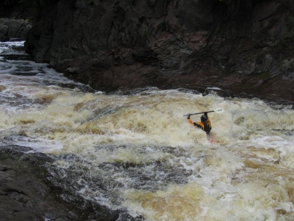
Triple drop started with punching a sticky powerful hole at the center where it flushed the most. It's a little challenging to setup a perfect line but is possible even for intermediate boaters. Immediately following this is a 8 foot steep slide/fall on shallow rocks, you definitely want to be in you're boat when you go over this one. The first hole is deep and does flush so if you do get stuck try to be persistent in getting out before pulling the skirt because of the consequences of what lies downstream.
At the level we ran at, the Eddy below Nokomis was very surgy and fed the disoriented boater straight into the munchy hole. It would be really hard to swim out of the boil. Less experienced paddlers would be served well to portage it because of possible consequences. If you decide to run it, safety rope is highly recommended. It's also advised to have more experienced boated setup much further downstream to collect the yard sale resulting from the swim. The 20 boat eddy that is mentioned in the previous comment does exist but only recommended for confident boaters because of the consequences of a possible slip. If you do end up slipping try to be as far left as possible, this is the only place were Nakomis flushed even a little. We eddied out one drop above Nakomis.
The bottom right of Lepisto falls was very shallow,sticky and violent. One of our members got sucked back and was endered before getting a bloody knuckle beat down on the shallow rocks. Up and over or left of the folded bed rock was a cleaner line.
Iagoo Falls was a series of three back to back bony slides with sticky holes at the bottom there a flushy easy to setup line for all and there's reasonable time in between falls at a couple of roll attempts before you get grated on the rocks.
Oct 12, 2005
Three comments:
One: I have heard rumors of epic hikeouts and found out after I hiked in that a great trail hits Copper Creek and brings you back to civilization. So, if for some reason you do have to get off the river make your way to Copper Creek confluence (the creek enters the Presque about 1/2-3/4 mile downstream of Nokomis and 1/2 mile upstream of LePisto) and walk the bank until you reach a path and go right. It will save you hours vs. trying to use a compass and just hiking one direction out through the woods.
Two: The south boundary road bridge gauge at 7.0 (October 2005) is a medium to high level. The Black was at 3.5 (780cfs) and didn't really drop during our time on the water. I remember a run in 2003 at 7.6 that seemed like about the same level
Three: You do not need to start your portage for Nokomis at triple drop. If you decide you are not up for running triple drop then more than likely you are going to walk Nokomis as well. However boat the distance between the two rapids instead of walking it! In fact there is quite a nice rapid along with a 1/4 mile of river between triple drop and Nokomis. There is a GIANT 20 boat eddy on river left above Nokomis. This will save tons of time and energy and give you an additional fun rapid!
I hope this info helps!
Have fun!
Peace
Brock
Aug 8, 2004
This is taken during a low water run in August. Although scrapey the scenery is breathtaking.
At typical levels Nokomis creates an ugly hole and walked by most. Low water allows a nice opportunity to run the drop with a good punch.
Even at low water this drop is into a good hole.
Pretty little drop through a tight squeeze for an open boat.
Jan 1, 1900
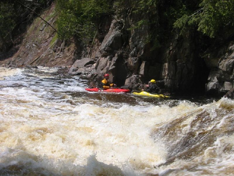
Jeorg and 'Kiffy' pause below the second drop in Triple Drop.