Nooksack, N. Fork
4 - Milepost 27 (Maple Falls) to South Fork Nooksack
| Difficulty | II |
| Length | 13 mi |
| Avg Gradient | n/a |
| Gauge | Nf Nooksack River Bl Cascade Creek Nr Glacier, Wa |
| Flow Rate as of 1 hour | 615 cfsrunnable |
| Reach Info Last Updated | June 1, 2024 |
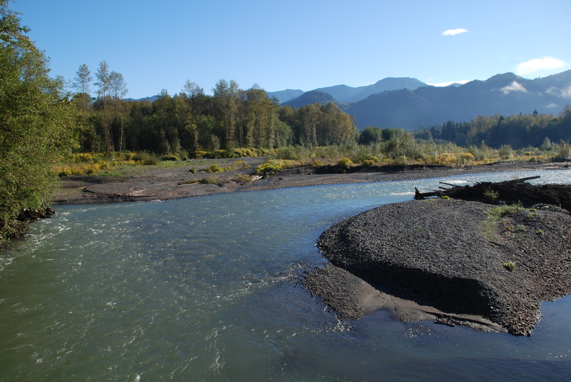
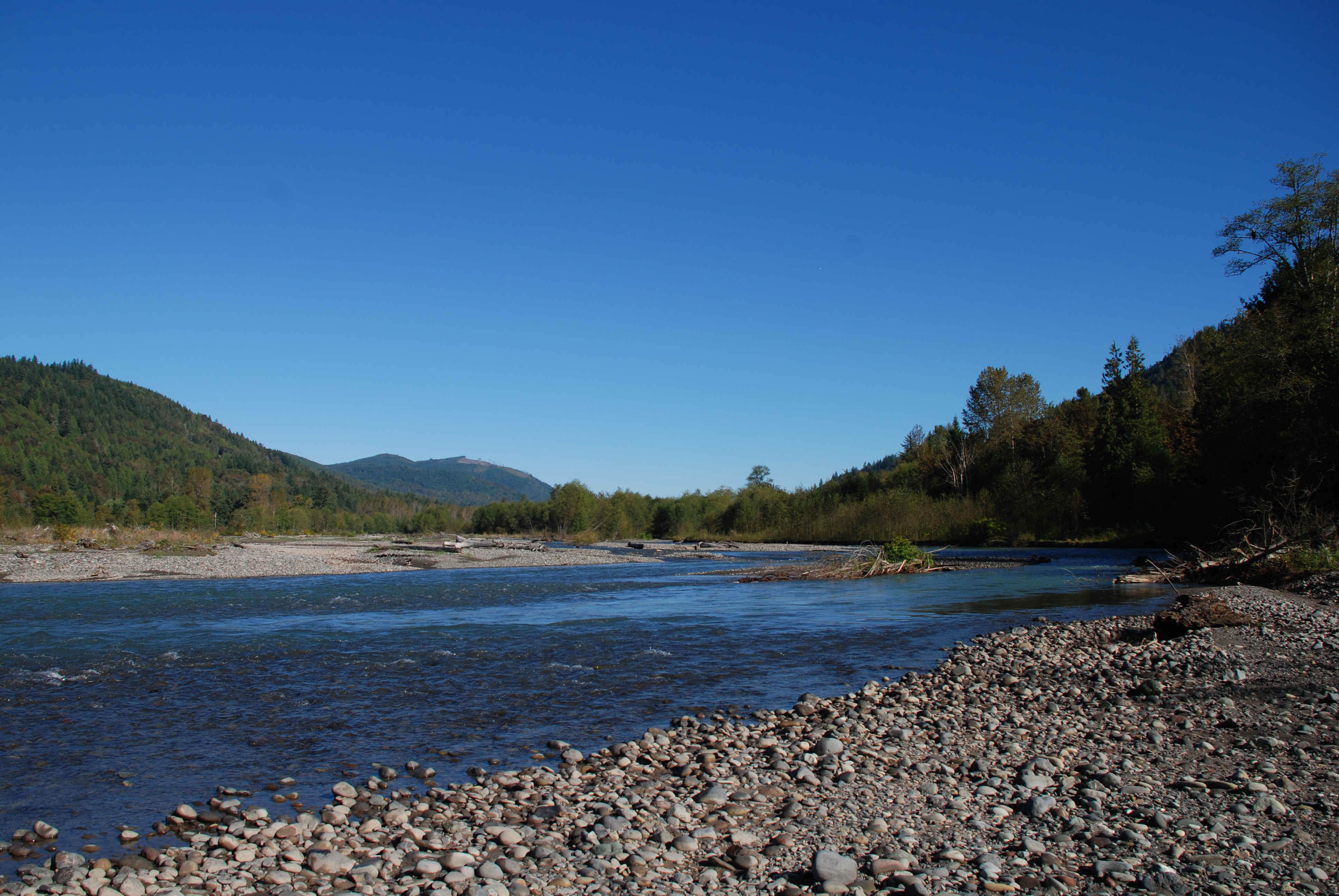
Class II river trip with sections of braided river channel and wood hazards. Great eagle watching opportunities in the winter. The river flows through a short canyon section as you float by Maple Falls at the start. While the river takes you through a rural landscape, you will find limited evidence of development and have the opportunity to experience a wild river that is rare in the Puget Sound lowlands.
Access: Access continues to be a challenge on the North Fork Nooksack. The put-in for this section is approximately 30 miles from Bellingham, east of the town of Maple Falls on Highway 542. Access points near milepost 27 are all on private property, with the exception of a small parcel of DNR land that could offer some opportunities. At mile 26.4 you will see a drive with a chain across it that opens into a small clearing (you will need to park along the highway but from the clearing it is a short walk to the river). This is the DNR site and is the only public land in the area. At mile 26.8 there is a paved drive (gated) that leads into a good site that outfitters have used with permission of the landowner. At mile 27.0 (upstream side of the milepost marker) there is another site which has also been used by outfitters. Both of these sites are closed off to the public and offer no parking unless you have the key. Some have used the access at mile 27.1 which has space for a car off the highway.
An intermediate access point is available at the Welcome Bridge where Mosquito Lake Road crosses the river. The access point was recently improved by Whatcom County and includes an easy river access and parking on downstream river left.
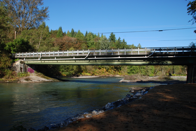
The take-out is at the confluence where the North Fork and South Fork come together. The Highway 9 Bridge crosses the river here.
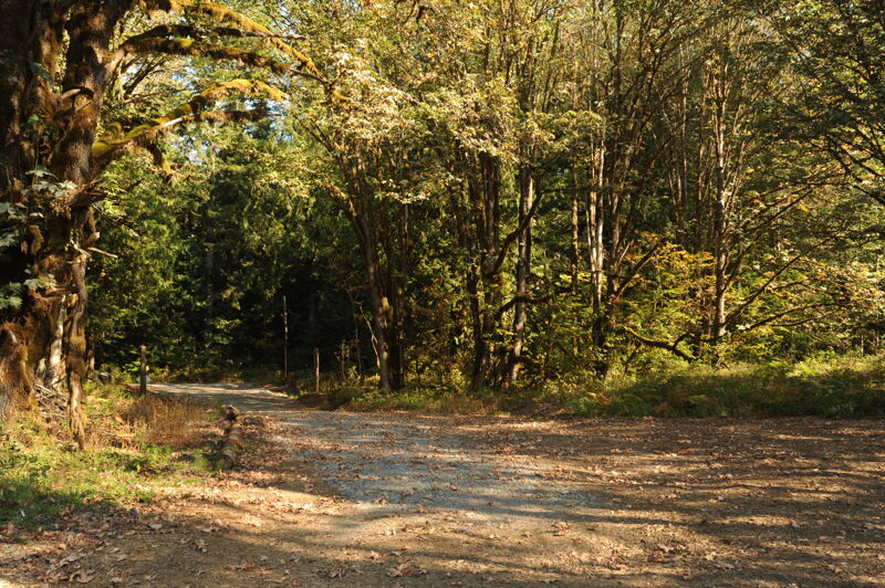
This access is at a small public parcel owned by Washington Department of Natural Resources at Highway mile 26.4. A cable is across the drive but you can typically get a couple cars off the road here and walk to the river. American Whitewater has worked to formalize this as a public access. The state got as far as developing a formal development plan for the site but has indicated they do not have the capacity for the project despite availability of funding.
Welcome Bridge river access on downstream river left where Mosquito Lake Road crosses the North Fork Nooksack River.
Sep 21, 2022
Site visit to discuss potential plans to formalize the Maple Creek Access site with American Rivers, American Whitewater, and Washington Department of Natural Resources.
Aug 3, 2022
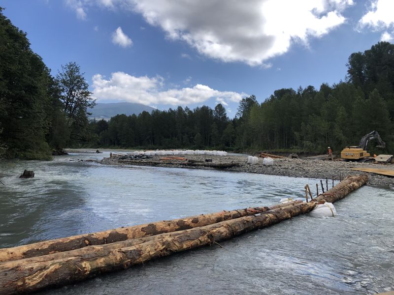
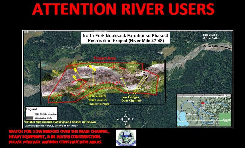
As part of the ongoing engineered log jam construction downstream of Milepost 27 near Maple Falls, low bridges have been placed over the channel and are impassable with limited to no portage around the upstream bridges. We advise all boaters to avoid the reach downstream of Milepost 27 from 8/2/2022 until 8/20/2022.
Please see the notification previously emailed to known river user lists for additional project information:
In an effort to ensure all river recreationists' safety and enjoyment on the river this summer, the Nooksack Indian Tribe’s Natural Resources Department would like to inform you that we will be constructing Engineered Log Jams (ELJ’s) and Flood Fence Structures as part of the North Fork Nooksack Maple Phase 2 Restoration Project this summer. The ELJ’s will be constructed within the active channel of the North Fork Nooksack River on both the right and left sides of the river.
The project is located between river miles 50.1 to 50.5 near Maple Falls, downstream of the informal river access at SR542 Milepost 27 and upstream of Maple Canyon near the Glen at Maple Falls development. Construction will occur July thru early September 2022. This is the last of two phases for the Maple Restoration Project.
Please be aware that bridges have been installed over the active channel as shown in the notification sign at the link below. In addition, please watch for heavy equipment, construction, and coffer dams (super sacks) in the channel. Large warning signs will be placed upstream of the bridges to warn boaters to exit the river.
The River User Notification Sign will be posted at popular river access locations and community boards in Glacier and Maple Falls. We will also be posting this information on the American Whitewater Association website. Please share this information with your club forums and/or share it with your fellow river users, guides, and clients. Please contact us if you or someone you know would like to be added to our river-user contact list for future updates.
Additionally, if you have suggestions for other river access sites where signs would be helpful or how to improve our notification process, please let us know; we’re open to feedback!
Thank you and have a safe and fun season on the water!
Jul 20, 2021
In an effort to ensure all river recreationalists’ safety and enjoyment on the river this summer, the Nooksack Indian Tribe’s Natural & Cultural Resources Department would like to inform you that we will be constructing Engineered Log Jams (ELJ’s) as part of the North Fork Nooksack Maple Phase 1 Restoration Project this summer. The ELJ’s will be constructed within the active channel of the North Fork Nooksack River on both the right and left sides of the river. The project is located between river miles 49.8-50.2 near Maple Falls, downstream of the informal river access at SR542 Milepost 27 and upstream of Maple Canyon near the Glen at Maple Falls development. Construction will occur July thru September 2021. This is the first of two phases for the Maple Restoration Project. Please be aware that bridges have been installed over the active channel. These bridges are low and impassible to boaters, please plan to portage around by exiting river left. In addition, please watch for heavy equipment, construction, and coffer dams in the channel. Large warning signs will be placed upstream of the bridges to warn boaters to exit the river. Please plan to portage around the project site! Photos of the bridges along with the River User Notification Sign are available upon request. Notification Signs have been posted at popular river access locations and community boards in Glacier and Maple Falls. Please post this information to your group forums and/or share with your fellow river users, guides and clients. If you or someone you know would like to be added to our river-user contact list for future updates, please contact us at the emails below. Additionally, if you have suggestions for other river access sites where signs would be helpful, or how to improve our notification and warning signs; please let us know, we’re open to feedback! Thank you and have a safe and fun season on the water! Eric Stover (Maple Project Manager)- estover@nooksack-nsn.gov Lindsie Fratus-Thomas (Farmhouse Project Manager)- lfratus@nooksack-nsn.gov 360-592-5140