Snoqualmie, Middle Fork
3 - Taylor River to Concrete Bridge(Upper Middle)
Dec 18, 2025
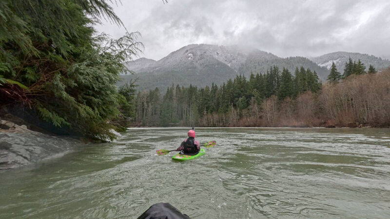
Three of us paddled in the rain from Bridgeview down to Russian Butte. Unlike the trip just 4 days before, there were trees down everywhere along the road from the recent windstorm. Thankfully, someone had gone through with a chainsaw before we arrived, so we were able to drive up all the way.
The river was still mostly clear of wood hazards, though there were a few easily-avoided logs that hadn't been there a few days previous. There is also still a log on river-right just before the Pratt confluence. Easy to avoid on river left, but hard to see it until you’re right there.
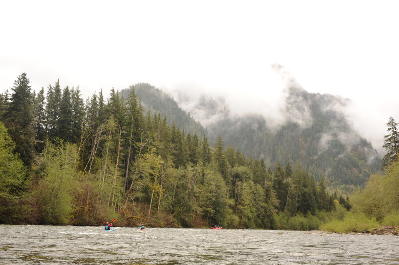
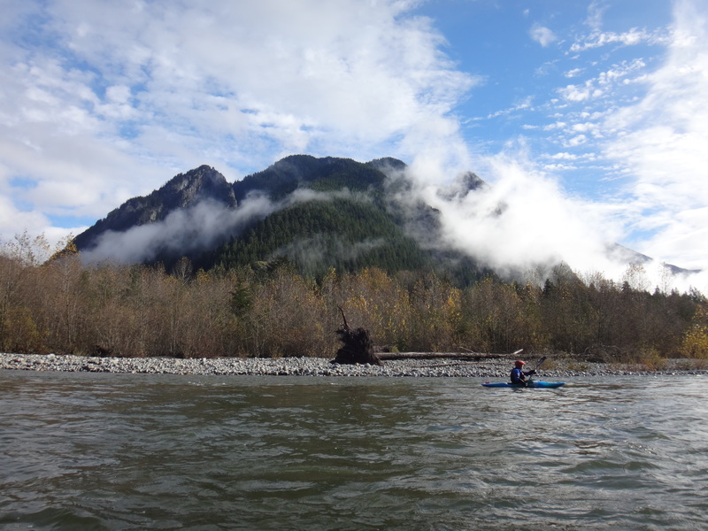
It rained hard the whole time, but was still pretty, especially with fresh snow on the low hills around us.
Dec 14, 2025
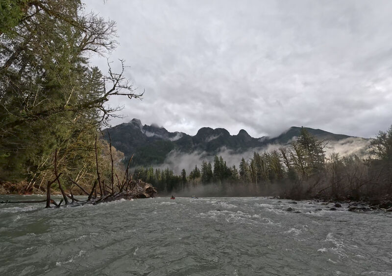
Five of us paddled from Bridgeview after the water levels came back down again after last week’s historic flooding. The road was clear all the way in, other than the 1-way section at the very beginning being closed. The Tanner gage was reporting 2,400 cfs, but we think that it might have been up closer to 3,500. The gages all probably need recalibration after the flood waters.
We were concerned about new wood hazards, but the water had been so high the week before (~20,000 cfs) that it seems to have pushed all the big logs and debris up into the surrounding trees, leaving the channel clear. The only log we encountered was on river right just before the Pratt confluence- it’s hard to see from up-river, but is pretty firmly wedged on some rocks and looks like a low-head dam. Plenty of room to get by it on the left.
This is always my favorite run for scenery- it’s just incredibly beautiful, especially with the mist rising through the trees. Lots of birds spotted- kingfishers, mergansers, dippers, and a big hawk.
May 4, 2025
May 18, 2024
Getting towards the lower end of the range but still acceptable with enough water to get down the river. It was just over 2 hours for the full Upper Middle run from the Taylor River down to Granite Creek. There were a few rock hits in a couple of the rapids.
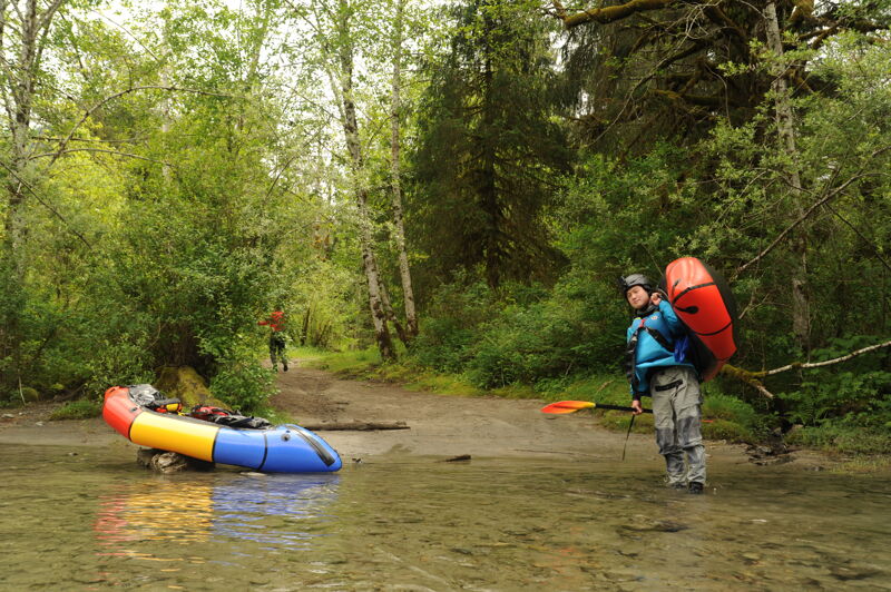
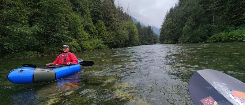
Packrafters walked a short distance up the Middle Fork Trail to put in just upstream of the Taylor River confluence.
We were surveying for Harlequin ducks and although we did not see any we saw 9 Merganser including one with ducklings and a pair of geese with goslings.
Apr 27, 2024
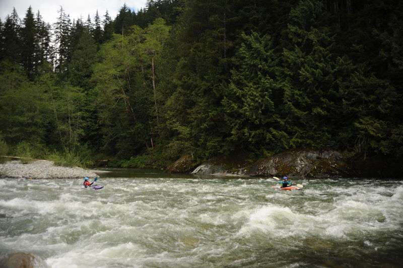
In partnership with the Forest Service, American Whitewater coordinated a harlequin duck survey of the Middle Fork Snoqualmie River by boat. This report is from one group that included 3 kayaks and raft that continued on down through the Middle-Middle. Participants included Tom, Jennie, Rachel, Andrew, Malia, and Mark. We saw two pairs of megansers (one pair just below the put-in and another pair just above the concrete bridge), but no harlequin ducks on the Upper Middle.
Jun 20, 2023
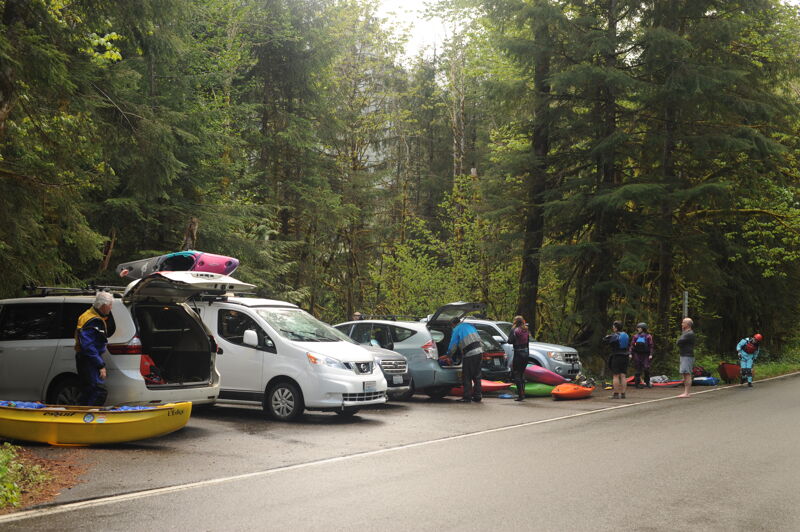
Took two packrafts on this section of the middle fork. Easy parking and access to both the put in and the pull out site. We were iffy on if we should even attempt this given the gauge was sitting a lower flow than the recommended runnable range. Despite the lower flow, we managed to run the whole section without ever needing to pop out of our boats. That being said I'm sure this river is far more fun at higher flows. Nonetheless the misty mountains made for a spectacular backdrop as one of the prettiest runs near Seattle. The run itself is straightforward, not too much to figure out and not much in the way of hazards. Most of the braids are fairly obvious to follow and we were able to read-and-run any rapid we approached. At higher flows I imagine it's even easier to run. We definitely had to pick lines carefully as more rocks were exposed in the river at this low of a flow. At this low of a flow, the river can feel slow and meandering, not much current to push you through the flatwater between rapids. Can't wait to run this again when there's more water in the river!!!
May 27, 2023
Went from the Taylor River put in to Russian Butte take out. No portage needed. Water level would be ideal at 2.5k. Today at 1.5k seemed a bit too low, but fine. Solid Class II+.
May 31, 2022
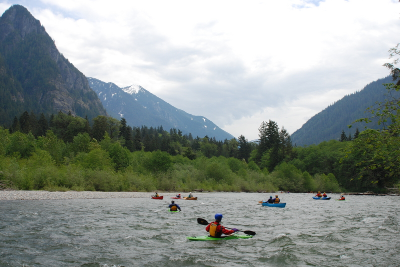
Middle Fork Snoqualmie Trip with Tom O'Keefe, Bethany Overfield, Doug Knapp, Kanako Iwata-Eng, Taylor Walker, Leanna Girton, and Cyn Taylor. We began our trip at the put-in upstream of the Taylor River confluence. We were treated to great views of the mountains which still have plenty of snow. An objective of our trip was surveying the river for harlequin ducks. We did not see any harlequin ducks but did see two pairs of merganser ducks and a solitary female, all in the segment between the Pratt River and Granite Creek.Video: < https://gopro.com/v/MJ6eeDgdpNXD7 >.
Nov 28, 2021
I went and scouted this section from the road today 11-28-21. The Middle Middle gauge was at about 2900 cfs. There's a new, very large river wide tree coming off river left to right at these coordinates: 47°32'18.0'N 121°33'32.3'W. It's above the Russian Butte parking area and visible from the road if you're looking for it. There's a second tree that's coming off the rootball upstream of the huge tree. This tree is pretty huge and will take some high flows to possibly get pushed out of place. There's a last chance eddy on river right but you have to have the boat control to ferry over to it. The rapid above is shallow on the right so you've gotta be left i there and then ferry hard to river right to catch the eddy and portage on river right over the tree. I didn't paddle the river, but I walked up the trail to this tree to confirm it was river wide. Happy paddling and be safe :)
Oct 12, 2020
Ran at ~1500 cfs 2020 Oct 11th. Plenty of hanging trees, especially on river right in inconvenient places where the flow wants to take you. Keep eyes downstream. It was all avoidable at this flow and higher flows might bury much of it.
Jun 14, 2020
Wood in play if you put-in above the Middle Fork bridge. It's high enough to pass under at ~1800 cfs, but there are some hanging branches to maneuver through. Right side seemed best.
After passing the MF bridge, all wood is visible and easily avoided if everyone is in their boats.
May 18, 2020
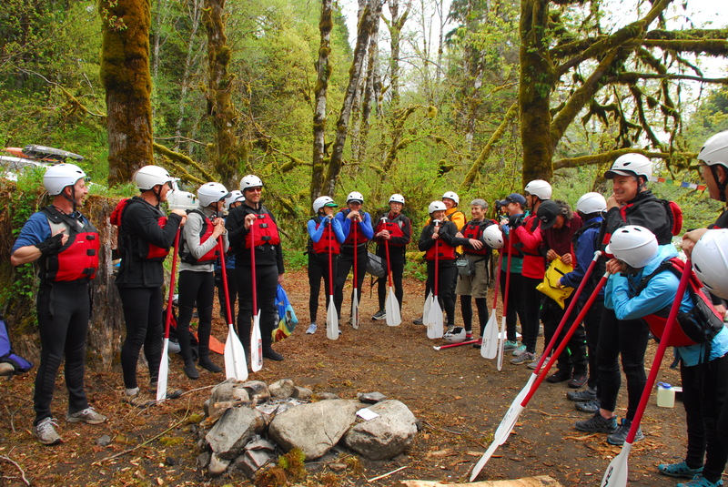
We got a few families with kids out on the river with each family unit traveling on their own and running a bike shuttle. Participants included James, Lucas, and Leanna Girton; Jan, Tracy, and Cassia Tackett; Aki, Taka, and Tom O'Keefe, and Cyn Taylor and Alder Peirce.
May 15, 2020
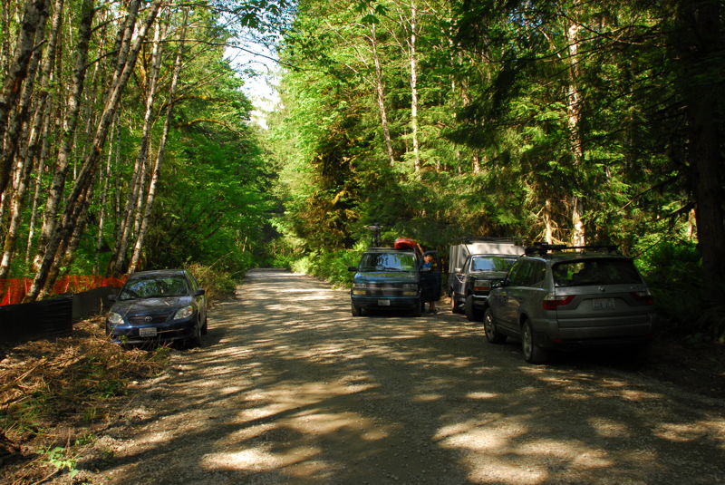
As of 5/15/2020 the road is open to the end of the pavement. A washout 1/2 mile past Taylor River prevents access to the alternate upper put-in. Taylor River has wood in multiple locations so don't recommend putting in there. Also the main trailheads/developed areas in the National Forest are currenlty closed but you can still access the river via small turnouts including the commonly used access spot 1/4 mile downstream from the footbridge/trailhead.
May 8, 2018
Trip with Mountains to Sound Greenway board, staff, and friends.
Dec 31, 2016
Upper Middle Trip
Jun 1, 2014
Out on the Upper Middle with Joe Shaeffer and his two kids Nathan and Rylie, Cyn Taylor and her son Alder, and Tom O'Keefe with his sons Aki and Taka. The kids joined the paddle raft and Cyn paddled along in her kayak.
Jun 15, 2013
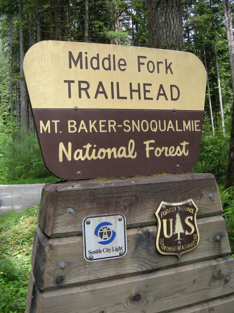
Trailhead sign with Seattle City Light logo and Forest Service logo on the Middle Fork Snoqualmie River.
Jul 11, 2010
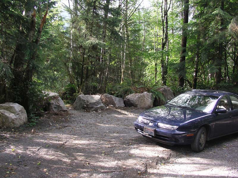
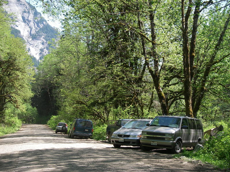
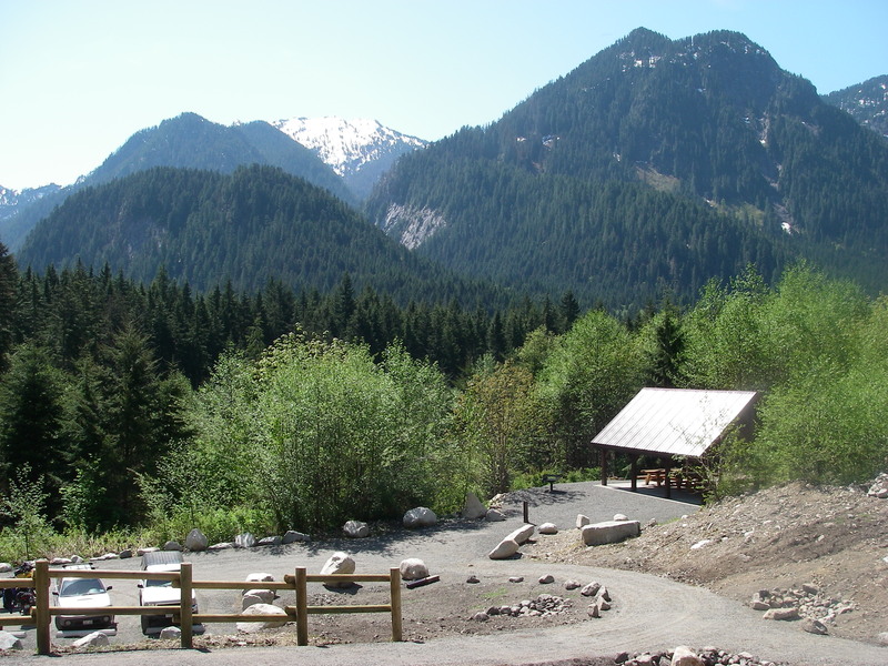
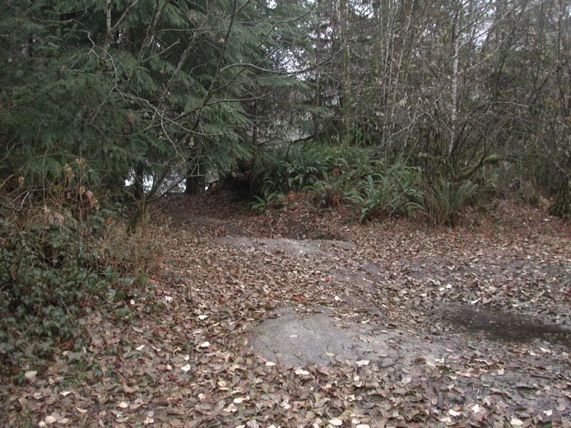
Russian Butte View access located
on DNR
land at road mile 8. This shows the
view of
the parking area after improvements
by
Mountains to Sound Greenway to
make it
easier for those carrying boats to
access the
river and address erosion issues. In
addition
to significant contributions made by
Mountains to Sound Greenway,
funding for
this project was provided by a grant
to
University Kayak Club and AW from
Tom's of Maine,
along with donations from
Washington
Kayak Club, University Kayak Club,
and
PaddleTrails Canoe Club.
Jun 1, 2008
American Whitewater led a trip on the Upper Middle Fork Snoqualmie as part of the day of activities hosted by Forterra in the Middle Fork Valley.
Jun 2, 2007
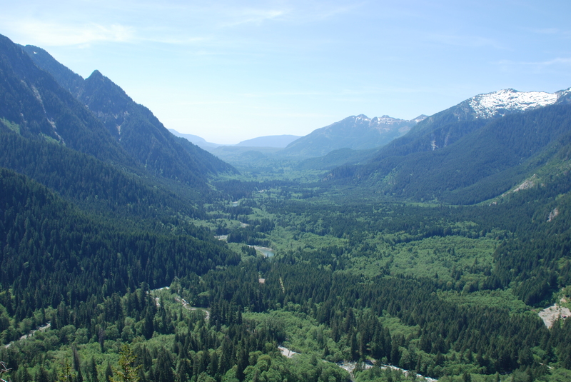
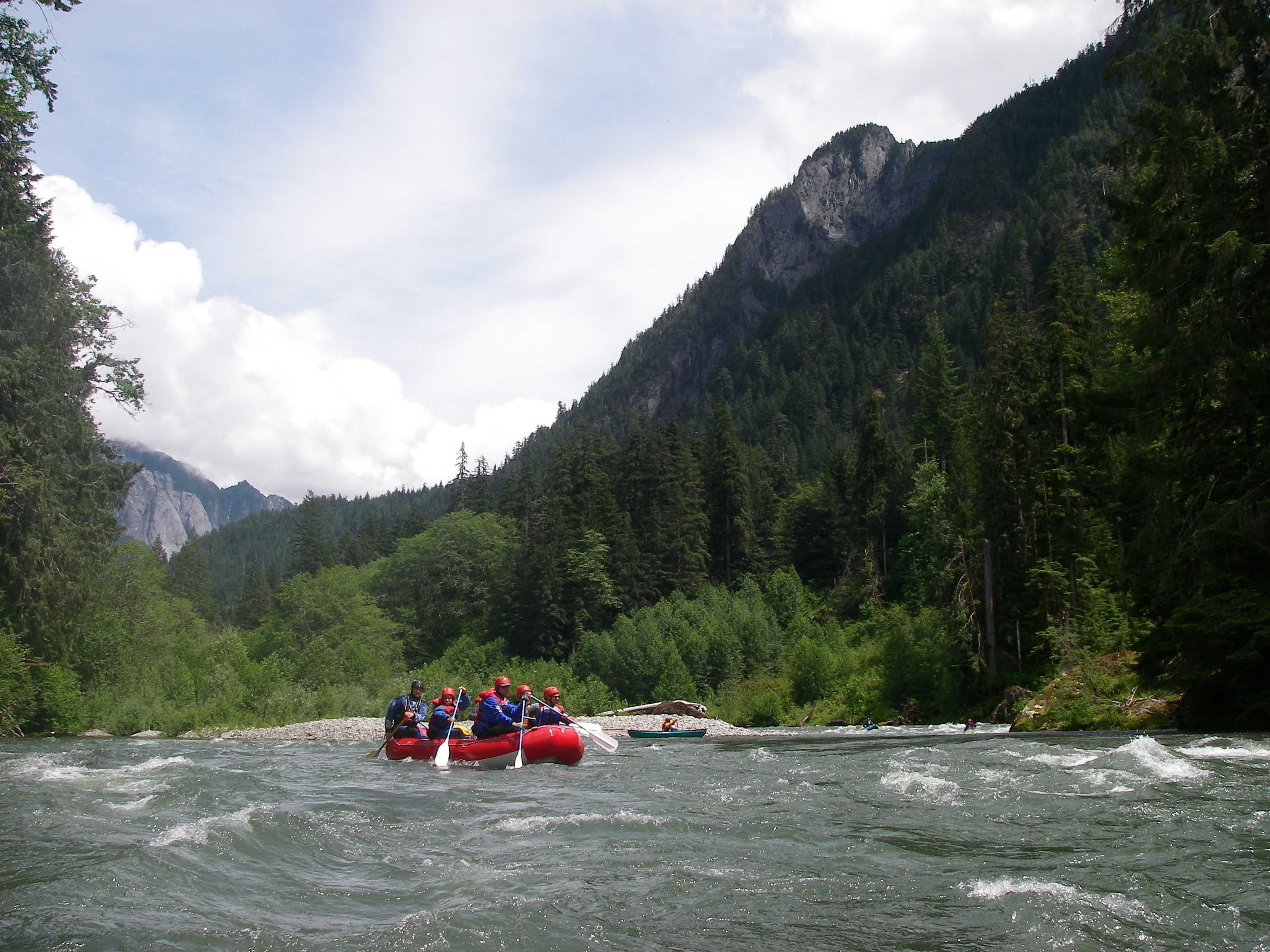
Looking down the Middle Fork Valley from the Garfield Ledges. The Middle Fork comes in from the left and the Taylor comes in from the right. Where these two rivers join is commonly referred to as the start of the 'Upper Middle' which continues on down the valley. This was a scouting trip to evaluate the opportunity to construct a trail up to the ledges.
Jun 5, 2006
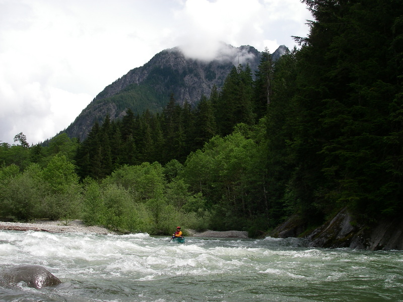
This is the most challenging drop on the Upper Middle where the river flows into a bedrock headwall on river left. It comes up as the first significant rapid from the put-in.
May 14, 2006
May 13, 2006
The new Middle Fork Campground with great views from the picnic area.
May 2, 2005
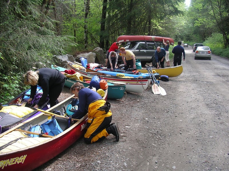
Loading up boats and gear at the Russian Butte View access point following a PaddleTrails Canoe Club trip.
Feb 8, 2005
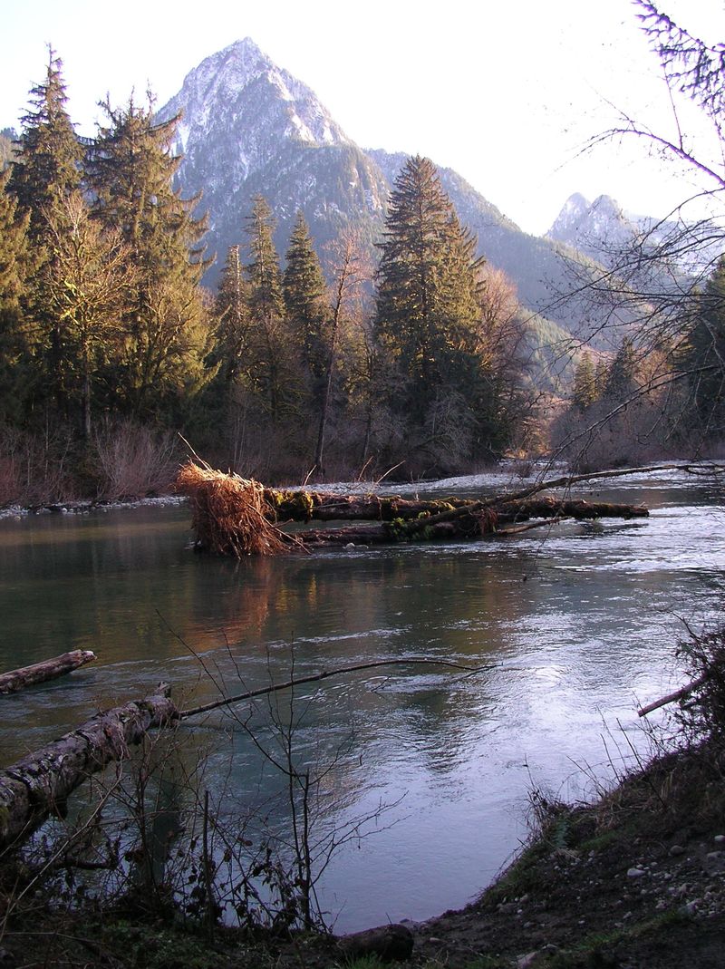
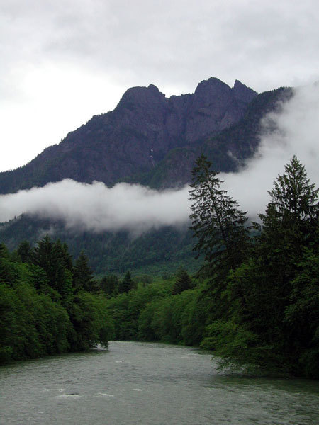
Looking up at Russian Butte across the Middle Fork Snoqualmie River.
Jul 20, 2004
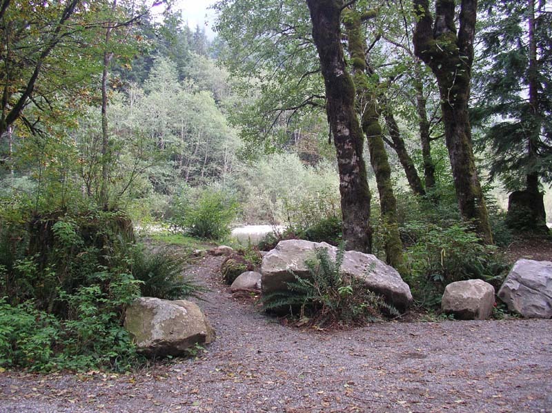
Russian Butte View access located on DNR land at road mile 8. This shows the view of the river trail after improvements by Mountains to Sound Greenway to address erosion issues and make it easier for those carrying boats to access the river. In addition to significant contributions made by Mountains to Sound Greenway, funding for this project was provided by a grant to University Kayak Club and AW from Tom's of Maine, along with donations from Washington Kayak Club, University Kayak Club, and PaddleTrails Canoe Club. The USFS identified this site as the preferred river access as a put-in for the Upper Middle following consultation with local paddlers. This site is just downstream of the Middle Fork Trailhead and it provides convenient access for rafts, kayaks, and canoes at a good eddy. During summer 2004 Mountains to Sound Greenway lead an effort to clean up the site and address erosion issues.
Nov 16, 2003
Russian Butte View access located on DNR land at road mile 8. This shows the view of the parking area before improvements. A large tank berm and mud pit made access difficult for those trying to carry boats to the river. Russian Butte View access located on DNR land at road mile 8. This shows the view of the river trail before improvements. Severe erosion was a problem at this site. American Whitewater worked with Paddle Trails Canoe Club and Washington DNR to make improvements to this site.
Jan 1, 1990
Upstream from bridge