Tuckasegee, West Fork
Thorpe Dam to Thorpe Powerhouse on Tuckasegee Reservoir(WF Tuck)
Jun 13, 2026
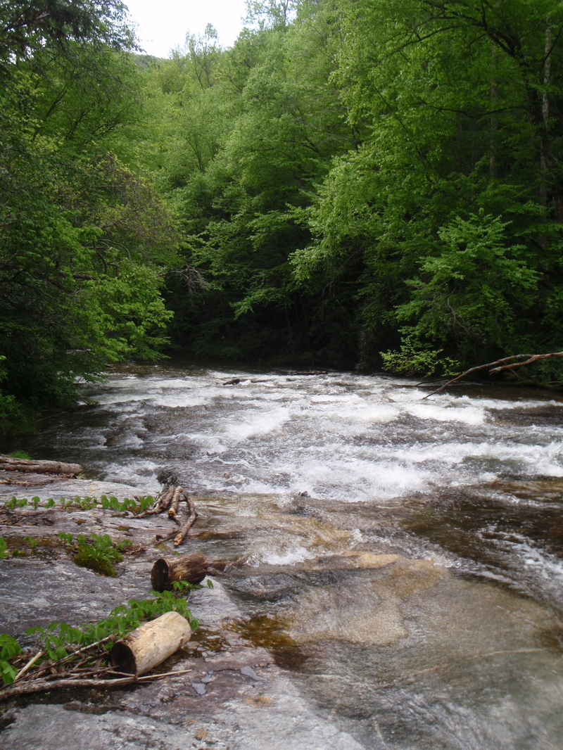
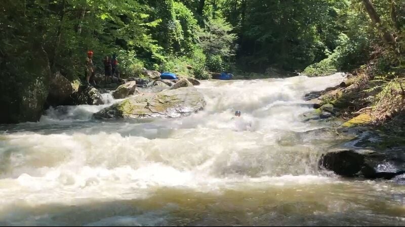
Was able to finally make it out for one of the 250cfs releases. In my opinion it’s class III read & run with 3-4 class IV rapids depending if you run the boulder gardens to start. Crux & Mini Gorge are good fun.
Nov 11, 2020
Jul 27, 2020
Please edit the main river description to reflect the fact that very few people now run the left side (Crash Landing) of the big drop for the reasons noted in the description. Flight Simulator is typically run about a boat length off the right bank with a slight left angle for best results.
May 1, 2020
Jun 8, 2018
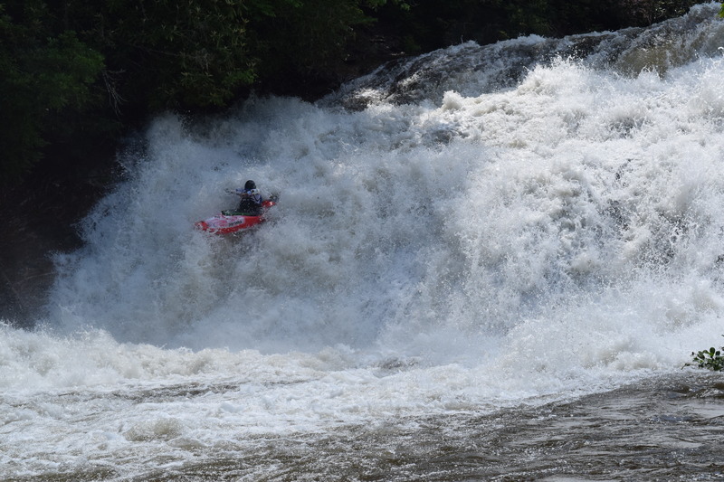
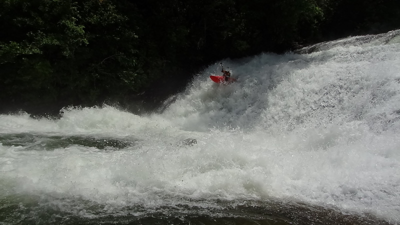
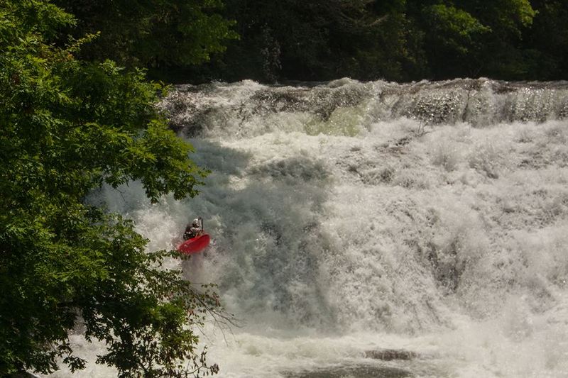
Breakbone Falls (aka, Flight Simulator)
Apr 9, 2018
4/7/2018
Apr 8, 2018
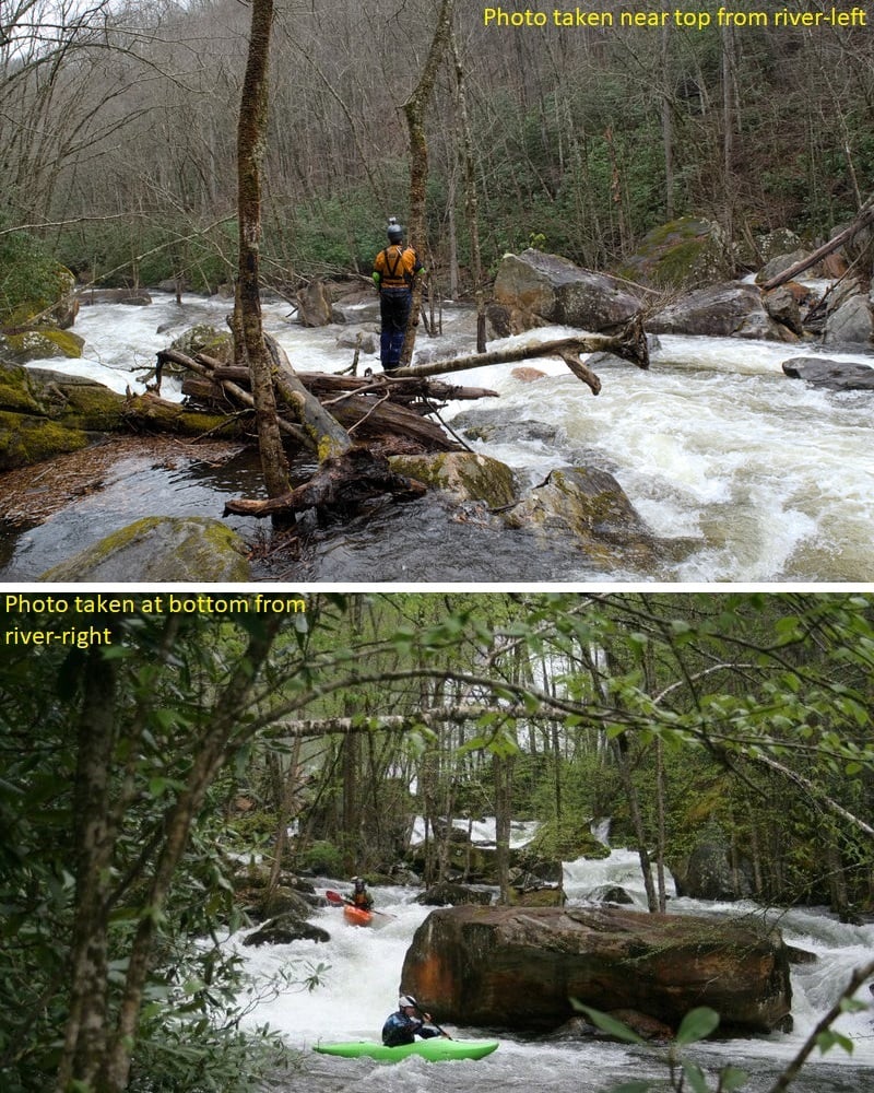
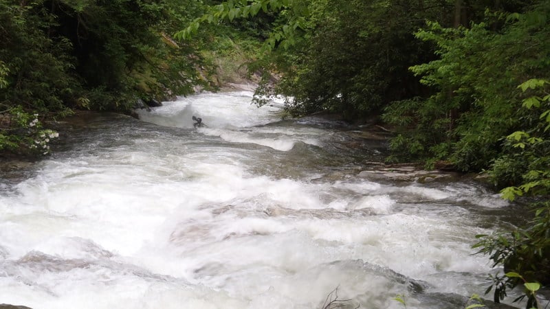
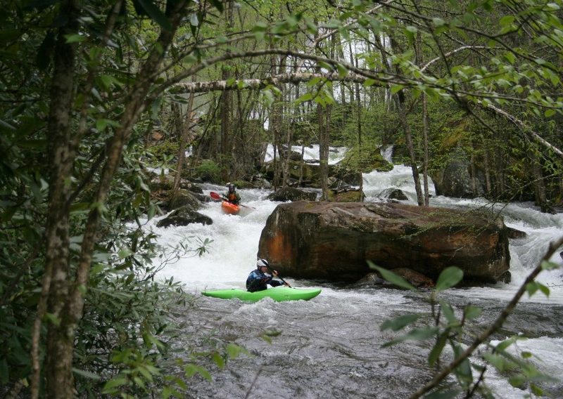
Second rapid of West Fork tuck below High Falls
Aug 31, 2017
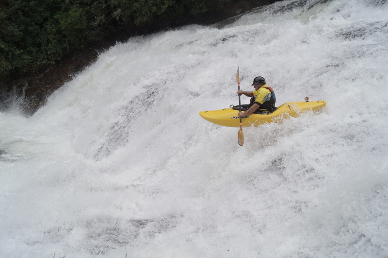
Unidentified boater on Flight Simulator
Jun 10, 2017
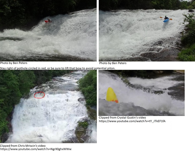
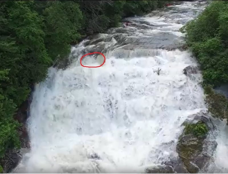
Pothole to avoid at top, right of Breakbone Falls (aka, Flight Simulator). Clipped from Chris Mriscin's video (https://www.youtube.com/watch?v=NgrX0ghxWWw)
Jun 4, 2016
Boyd going over first boulder ledge in Second Boulder Garden. Clipped from Boyd Ruppelt's video (https://www.youtube.com/watch?v=M1-mHq90j0Q)
Jun 4, 2016
View from top of Kornegay's Cascade. Clipped from Boyd Ruppelt's video (https://www.youtube.com/watch?v=M1-mHq90j0Q)
Apr 7, 2016
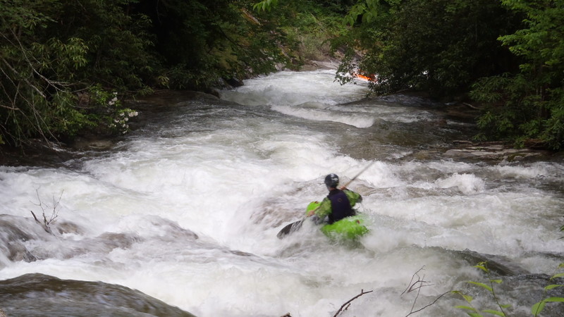
another test
Aug 22, 2015
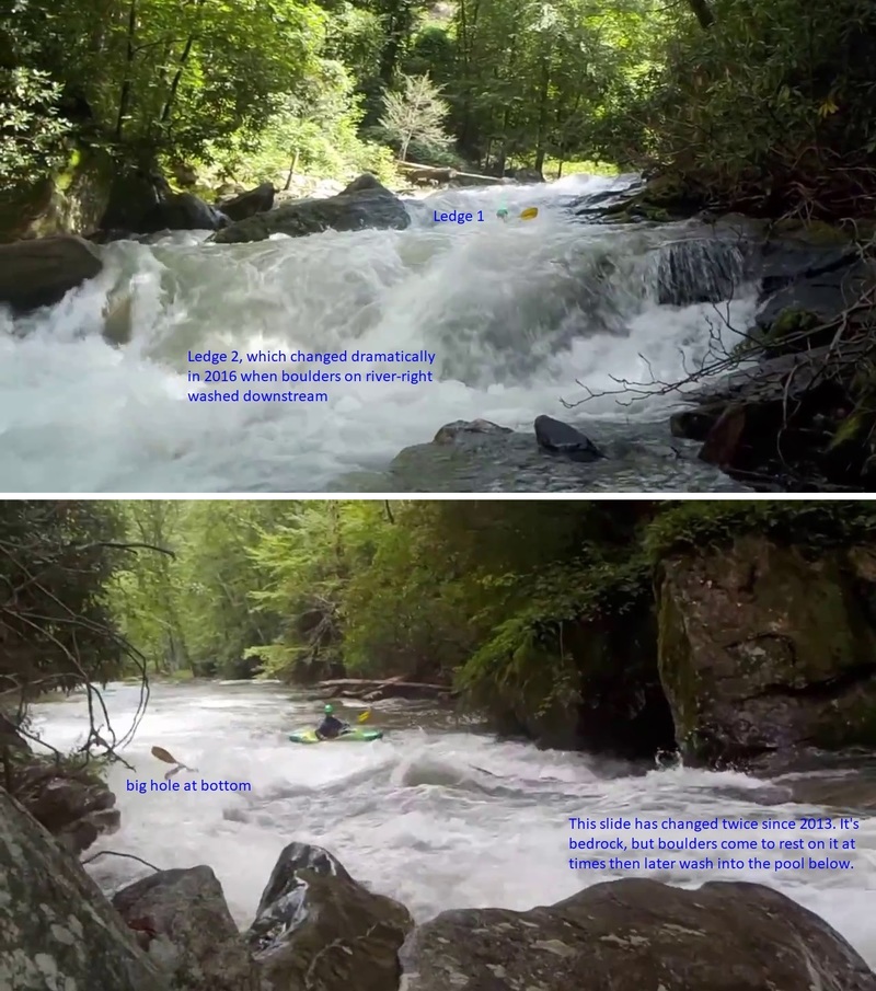
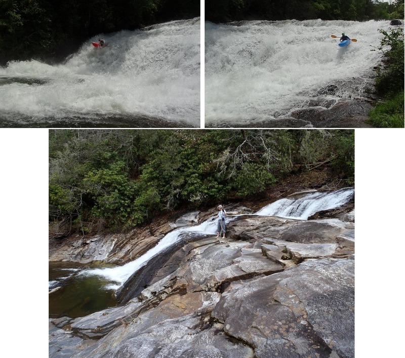
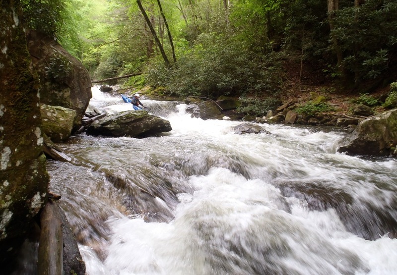
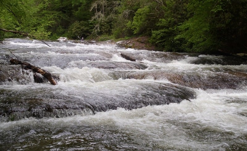
Top half and bottom half of first rapid in mini-gorge of West Fork Tuck
May 23, 2015
A beautiful spring day in May, 2015. Photo by Mike Mays.
May 12, 2014
Left Line in Overflow X
Apr 18, 2014
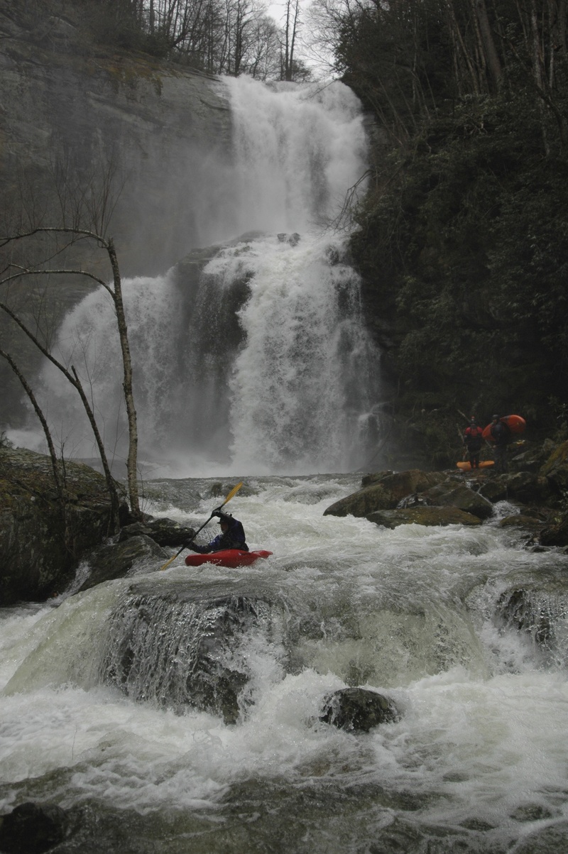
River-right line (Wade Harrison) & river-left line at 250cfs by Ben Peters on 8 June 2013. Center and river-right at base flow on 12 April 2014 by Burt Kornegay
Apr 4, 2014
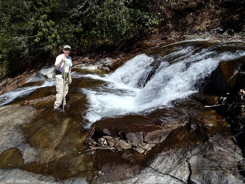
There is quite the deep pool at the base of this little drop - keep those bows up!
Apr 4, 2014
Note the small landing zone pocket on the river right line. Missing this zone has caused some pitons. Also note the pothole to the left of the person.
Apr 4, 2014
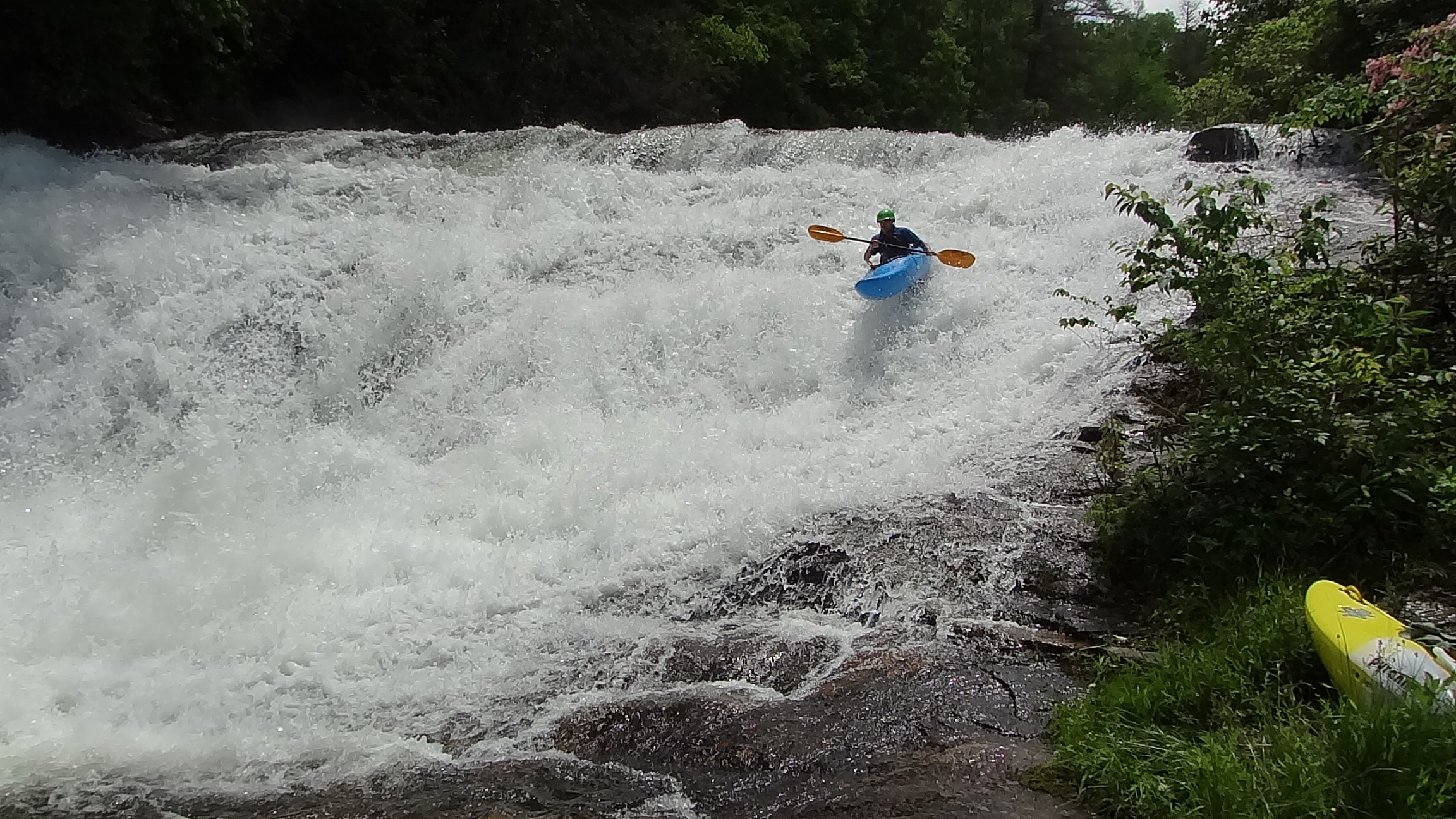
Looking up at the big slide you can see a pocket in the center, and the steep drop onto a flat surface right at the person's head where people have been injured. Its a skate park - find the smooth line.
Aug 14, 2013
The takeout stick gauge was showing 2.5~ft. for the 250 CFS release on
8-10-13 . At that time I found folks asking when it would start to release.
Don't let view fool you, it does look low, so check the gauge.
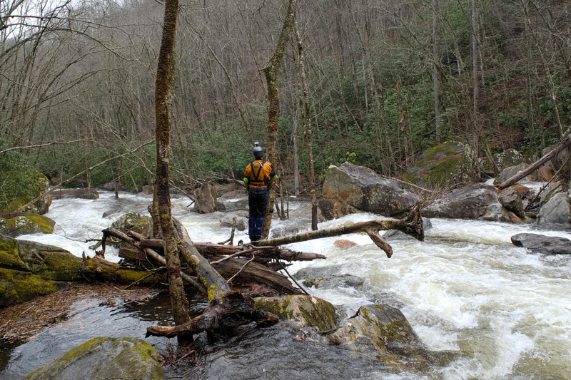
Also new long tree down across the run very shortly below the little bridge.
Approach with caution and go center-left and forget the top eddie on right .
At This Time, the tree is still green leafed and help up by it's branches for now.
We ducked under it fine , this time.
Check this link for Duke Energy Updates for the West Tuck Fork :
http://www.duke-energy.com/lakes/levels/LakeMessage.asp?lake=lake-glenville
Aug 2, 2013
Jason Harris firing up the left line
Jul 26, 2013
Second boulder garden on 18 July with no flow from Lake Glenville, and on 26 July with stick across from Thorpe Powerhouse reading 2.4 feet. Rapid was dramatically altered by high flows in early and mid July.
Jul 18, 2013
Bottom of first boulder garden. Photo taken from slide between boulder gardens. Compare to photo of second boulder garden taken from the same spot to get an idea of distance between boulder gardens.
Jul 18, 2013
Top of second boulder garden visible near the center of the photo. Photo taken from slide between boulder gardens. Compare to photo of first boulder garden taken from the same spot to get an idea of distance between boulder gardens.
Jun 8, 2013
River-right line (Wade Harrison) & river-left line at 250cfs by Ben Peters on 8 June 2013. Center and river-right at base flow on 12 April 2014 by Burt Kornegay
Jun 8, 2013
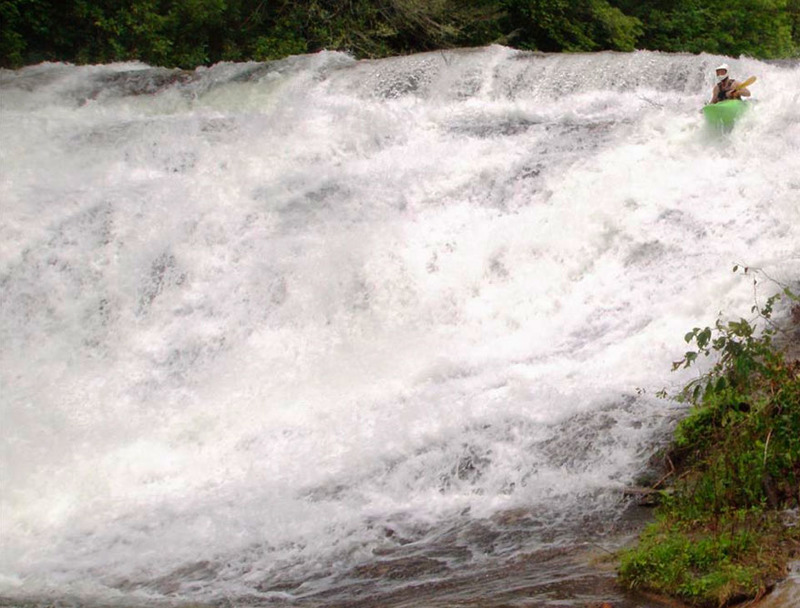
Wade stomping the autoboof on the big slide.
Jun 8, 2013
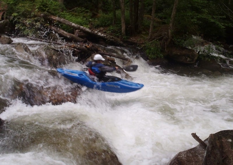
Paddler, David Jaben, dropping into the last rapid of the mini gorge.
Jun 8, 2013
Good example of a correct line
Jun 8, 2013
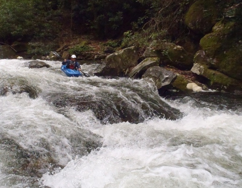
Third rapid of mini gorge, Lumpy Ledge, in the foreground. Center-right crevice just to the left of the boater, David Jaben.
Jun 8, 2013
Right (more difficult) line
May 23, 2013
Looking upstream at first boulder garden
Apr 28, 2013
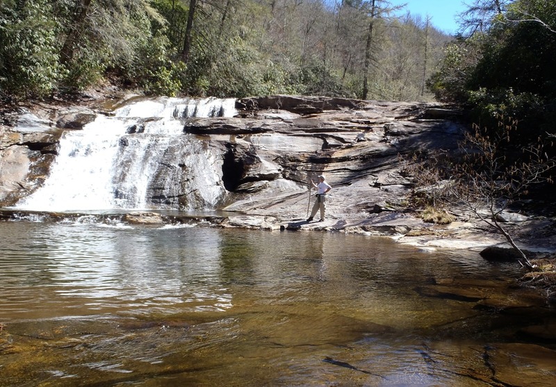
Third rapid of the mini gorge, Lumpy Ledge, at 3 feet
Apr 14, 2013
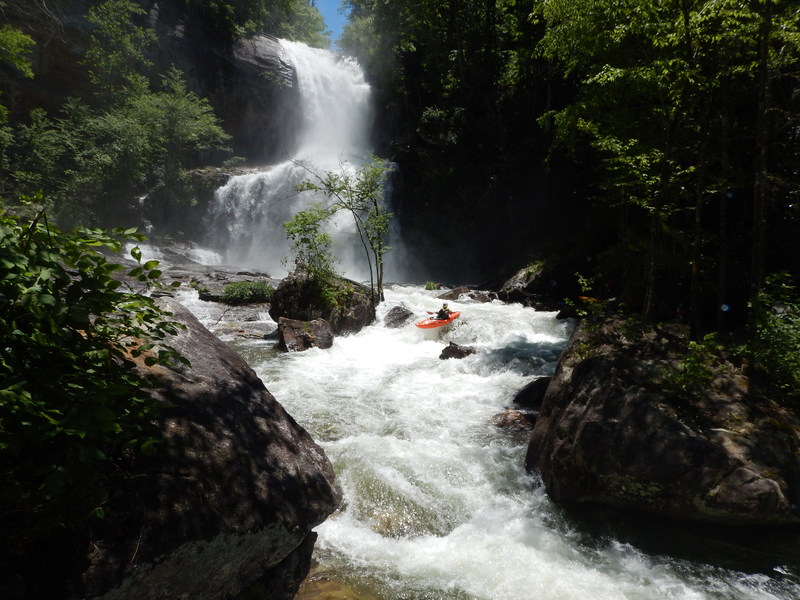
Brian Jacobson enters the put-in rapid on the West Fork Tuck with Cullowhee Falls as the background.
Dec 29, 2012
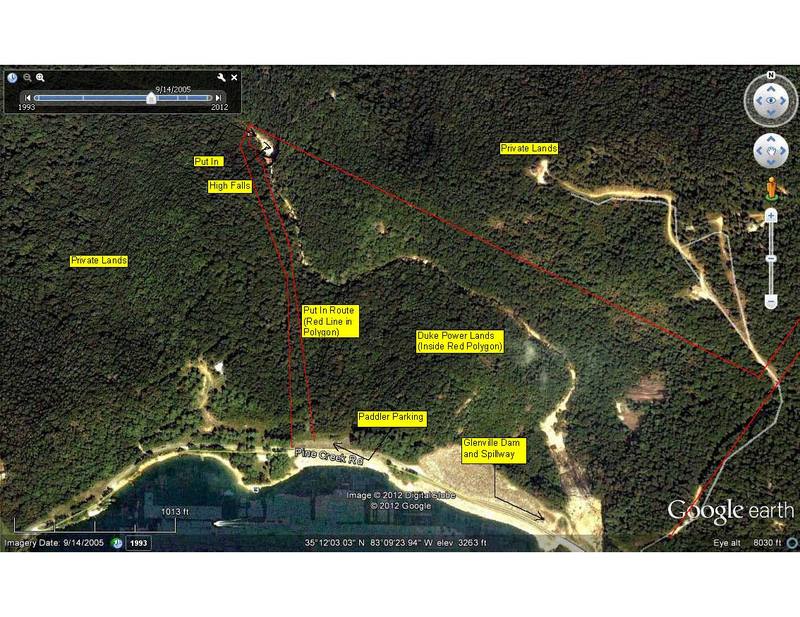
Hiked down the trail to the put-in today. Starts out as a dirt road then a well constructed trail starts on the right as the dirt road continues left. The well - constructed trail continues for a short distance, ending in a clearing with a bunch of trees that have been cut. The dirt road comes back in and continues for a couple of hundred feet, then turns into an unimproved (narrow, muddy, slick) trail. This continues past the first waterfall that is huge. The trail continues, eventually dropping below a set of cliffs near the top of the second waterfall. The trail then turns into a scramble among rocks, logs, and trees down the hillside until it is nearly even with the bottom of the first of the two drops in the second falls (huge, lands on rocks). The trail (if you can call it that at this point) continues down amongst the large rocks, logs, and trees into a large patch of rhododendron until it meets the river at the bottom of the second drop of the second falls. It was a difficult hike without a boat. With a boat it would be best to use a rope to lower the boat down to someone waiting below in stages. It will take a LOT of work to turn the current scramble into a trail walkable with boats.
May 8, 2012
class IV below Cullowhee Forest bridge about .3 miles downstream of the bridge
May 8, 2012
slides on the lower 3 miles
May 8, 2012
classic slides on the lower 3 miles below Cullowhee Forest Bridge
May 8, 2012
bony boof with wood
May 8, 2012
ledges on WF Tuck
May 3, 2012
Approximate location of Duke Property (open to public use) and the route to access the Upper West Fork. Stay on Duke property at all times - often marked with red flagging tape and tree markers. Launch only below the second big waterfall as noted. Note that things are busy (eg Class IV or maybe even V right off the bat). A relatively easy route around the big waterfall exists under a cliff band well uphill of - but near - the lip of the falls. In the fall of 2012 a nice hiking trail will be built to this location, so if you have any route finding doubts - just wait for the releases in 2013.
Jul 11, 2005
Ran this yesterday (just happened to catch it- don't know the flow, so I might be overestimating what the river will be like at release and my comments below might be overinflated) and have to make some comments:
this is a creek, so if you don't have skills to run stuff like the North Fork French Broad, Lower Big Creek, or similar stuff, you will find this a little big for your taste. The reason I say this is based upon the number of holes (some pretty sticky), the amount of trees, and the overall difficulty of a couple of rapids. One rapid in particular, located about 1/3 to 1/2 mile below the bridge at Cullowhee Forest development is a Class IV/IV+ (maybe a V at high water) due to the two holes in the rapid, and an undercut I noticed. It has 3 or 4 moves in it, and drops into a pretty nasty hole on the bottom left. Be careful and be good at boat scouting if you've never run this, you'll be in boogie water alot in some sections.
Overall, I think it is going to be a gem of a run (the water was crystal clear)- we just need to get some strainers moved out of there.
-Newton
Aug 12, 2002
AW has recently completed our access proposal for the West Fork that includes protection of roughly 1,000 acres of old growth and cliffs, from the dam to the base of high falls.
We hope to reach a negotiated settlement on flows and access in the West Fork sometime late in 2002.
Aug 12, 2002
Read a story about the 2001 Flow study on the West Fork that appeared in the AW journal in the fall of 2001, you can find it online at:
http://www.americanwhitewater.org/resources/repository/West%20Fork%20Study.doc.LNK.doc
Jan 1, 1900
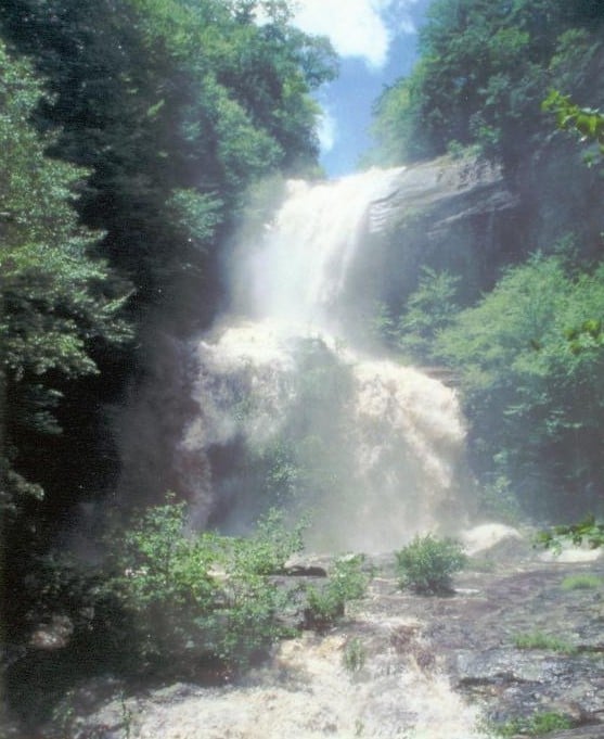
This is the first time this waterfall had flowed in 20 odd years.
Jan 1, 1900
Ryan being grabbed by the sneaky speedtrap hole halfway between High Turnover's first two ledges (27 July 2019). Level bouncing between 2.8ft and 2.9ft at the takeout.
Jan 1, 1900
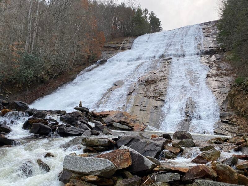
I took this photo standing next to High Falls, from where the put in trail will descend around the falls, during an access study that required a brief release from Glenville Dam. We'll need your help building the trail. This waterfall will once again be a waterfall when releases start in the spring of 2006. For now it remains dry, as it has been for decades.
The put in trail for the West Fork will terminate at the 3-4 foot drop in the foreground, and paddlers will either put in above or below this drop based on personal preference. High Falls is visible in the background.