Lehigh
2. Rockport to Glen Onoko (Lower)
| Difficulty | II-III |
| Length | 13.1 mi |
| Avg Gradient | 30 fpm |
| Gauge | Lehigh River Rockport to Glen Onoko |
| Flow Rate as of 28 minutes | 639 cfslow runnable |
| Reach Info Last Updated | June 10, 2024 |
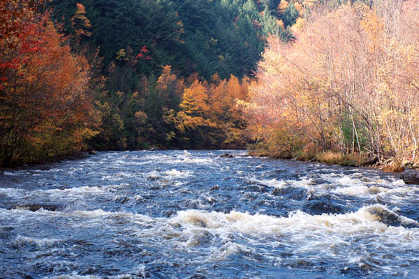
The Lehigh River is a pretty dam-controlled river in eastern Pennsylvania. It offers paddlers several sections of good class III rapids in a forested river corridor. It also is the first (or only) taste of whitewater that many people in the Philadelphia area get to experience. The river is [...]Read More
(Check recent gage adjustments described in 'Gage Description' under 'Flow' link.)
Longer and more scenic than the upper section, it has more challenging rapids, but more flat water.
Related web sites: ab257's Lehigh Page Lehigh River Water Trail
The weekend releases are posted Wednesdays and finalized Fridays at:
Army Corps and reservoir levels can be found at: Francis Walter Dam
This section is a 13 mile run from Rockport to Glen Onoko, both PA State Park river accesses. (The town of Jim Thorpe has a river access another 2.7 miles downstream from the Glen Onoko access, which would provide another 2.7 miles of mostly flatwater/moving water -- nothing more than mild Class II).
A bike trail follows the river along an old railroad bed from White Haven to Glen Onoko as part of the state park, with bike rentals available locally. The river is administered by the PA Dept of Conservation and Natural Resources. There is a steep trail starting at the parking area at Glen Onoko that goes up to the top of a multi level water fall. The park administers access to the river as well as the bike trail. The eastern shore of the upper section borders Hickory Run state park, with some hiking trails down to the river. The whole White Haven to Thorpe area has a long history of coal mining and tourism. Water levels are dependent on the releases from the Francis Walters dam, operated by the Army Corps of Engineers, planned weekend releases are u
...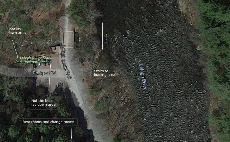
Put-In - You can drop off or pick up boats at the bottom of the hill, but must park in the State Park's parking lots at the top of the hill. Access to the road at the bottom of the hill is controlled by the DCNR Rangers
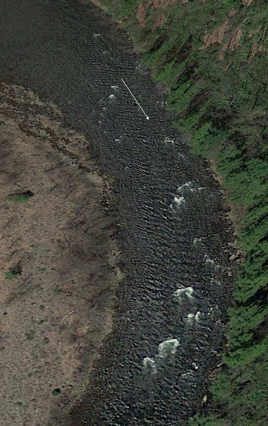
Just below Rockport there is a large eddy on the left. Just below the eddy is a squirt eddy line off the right bank. Run to the right of the island below the eddy. A small glassy surfing wave is in the center at the start of the rapid. Follow the main current down the center of the river. At high water, the island can also be run to the left.
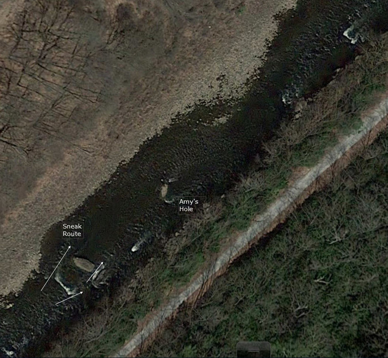
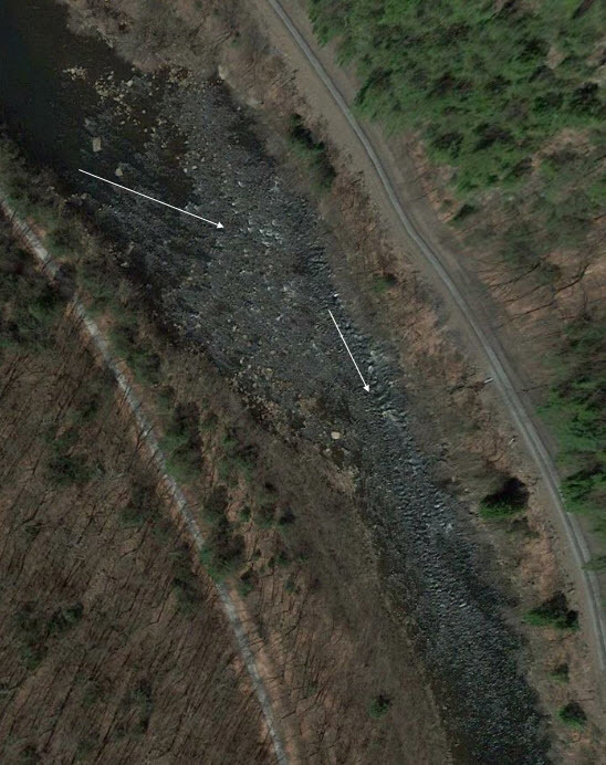
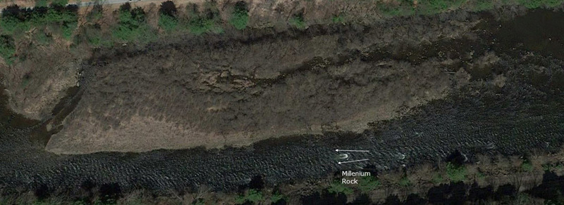
Satellite Photo 1
The river bends to the right, and the main current piles up on a large rock just off the left shore. You can eddy hop down the rapid along the left shore, with some nice eddy fences to punch. You can also run a slot to the left of pinball rock, but the best waves are to the right. The whole rapid can be snuck by staying to the right side of the current.
A large rock at center right divides the current, with a smaller rock to its right. Approach the rock from the right side (avoiding a ledge sticking out from the right shore) and thread in between the two rocks. Eddy out behind either of the rocks. The rapid can be snuck to the left of the rock for the wimps among us. Below the two rocks, in the center of the river, is Amy's Hole, which can get very sticky at levels above 1000 cfs (actually Amy's is the second rock/hole below the eye). Named after Amy Yuan(?), former adventurous (or gullible) Challengers guide (really, it a great surf in there - go for it).

Drake's Creek enters from the left near the start of the rapid (also a put-in for Pocono Whitewater and an emergency egress from the river). A large ledge juts out from the left hand shore below the creek with eddys below and above. Follow the main current just to the right of the ledge for some nice waves.
So called because of an abundance of little rocks at low water (also called Stuckies). Enter rapid to right of large rock in the center of the river and then follow the current to the left as it goes down thru a small rock garden. At higher water you can enter to the left of the rock and avoid some of the rocks.
Not quite a mile long, but still the longest rapid on the river (other than perhaps Sea of Rocks, which at low water seems twice as long). Avoiding a piece of metal just above the island, run to the right for a narrow twisty passage, or to the left for a senic view of an old boxcar left over from a train derailment. Below the island is a long rock garden type rapid. At 1000 cfs or above check out two side surfing hydraulics on the middle left side. Below this work your way gradually to the right until you reach a surfing/pop-up wave/hole near a pyramid rock on the right shore. Continue on down and eddy out on the left before Little Swimmers. Watch out for a metal beam sticking out from the right shore at the top of the eddy, and for submerged metal on the bottom/left of the eddy.
After some riffles and a large eddy along the right shore you enter White Falls (or Little Falls, or White Chairs because of some chairs along the river bank when rafting was first starting). Pass just to the left of a pinning rock in right center. Cut behind the rock down to a washed over ledge running diagonally across the river. Pick out a clean looking slot, and shoot on thru. The right side above the ledge is rocky and shallow. Just above the island at the start of the next rapid (Mile Long) is a rock (exposed at 400 cfs) with some raft ripping metal sticking out of it.
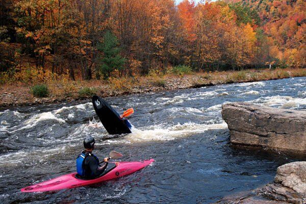
AKA 'Bridal Veil'. The second most challenging rapid (after Tower) Little Swimmers (or Bridal Veil) starts to the right of the island below the pool (watch out for submerged metal at the bottom left of the eddy). Avoid (or surf) a hydraulic coming out from the right shore, and stay in the center through some big waves coming at you from all directions. Below these waves is a short stretch of calmer water with a pinning rock dead center. Cut behind this rock and go through a chute in a gap between two large rock ledges (Little Swimmers). The rapid gets much less pushy below this. Pick your way through the rocks, but don't get caught going down a shallow channel to the right of a low island. In flood conditions the two rock ledges become a set of raft flipping monster holes called Chiller and Thriller.
The river is narrowed by an island on the right. Go straight down the middle of the channel through some nice waves. Work your way to the right at the bottom. You can have an early lunch on the rocks at the bottom of the island, or at a beach on the right shore.
Former site of a small railroad junction town, the Lehigh makes a left turn, and the current goes past a high rock retaining wall on the right. A flipping rock juts out from the wall, with a nice eddy behind it and a surfing wave alongside the eddy. Across from the rock is a nice lunch spot on the left shore. Below is a railroad bridge and Quakake Creek coming in from the right side. At high water the two bridge piers are placed perfectly for pinning and wrapping unwary rafts. Black Creek to Quakake to the Lehigh is a nice Class III (III-IV at higher water) creek run from Weatherly after a heavy rain.
AKA 'Double Barrel'. Similar in character but larger than P in the A rapid. Start Hurry Left (or Double Barrel rapid) to the right of a small island in low water and follow current to the left. Avoid numerous rocks as you work your way towards the left side. Some nice eddy hopping if you feel energetic. Avoid the right side unless you enjoy dragging your raft off of rocks. At higher water, you can run to the left of the island for a cleaner shot over to the left side.
After Hurry Left, the river gradually bends to the right. A horizon line indicates a long ledge coming out from the left shore. There is a clean chute on the right side, leading into a small wave/hole that is a great surf. Right below this are some lunch stops for rafting companies (a good place to avoid due to rattlesnakes), and a mile or so of flat water (with occasional head winds) up to Rattler and then to Bear Creek.
Only memorable because it relieves a little of the boredom from the flatwater in this stretch. The river bends gradually to the right, with shallows on the right side, and the majority of the current along the left bank. About half way down there is a rock about 3 foot from the left shore. Go to the right of it, there is no way a raft will fit between the rock and the shore (believe me, a lot of people have tried).
AKA 'Pipeline'. At the deepest part of the Lehigh Gorge, the river makes a large oxbow bend. Bear Creek comes in from the left into a large calm area at the top of the rapid. Enter from the right side (just to the left of some rocks). The current will carry you to the center as the river bends to the right. As you come around the bend there is a large rock ledge sticking out from the left shore with 45 minute (thats how long it takes to get your raft off of it) rock ready to grab you if you get too far left. Just below in the main current is a wave/hole that at the right level can give kayakers a bouncy surf for a couple of seconds. A long stretch of Class II follows with a few holes in the center. Along the left is a sheer rock wall with some nice waves along it. The last wave in this stretch has an eddy next to it along the wall, and will give you pop-ups if the level is not too low. As you come around the left bend below this section there will be a beach on the left, and a pipeline running overhead. One of the first oil pipelines from the central PA oil fields, now used for natural gas, it gives the rapid its other name - Pipeline.
A rock garden with a few ledges and usually minimal flow. Good chance ot practice eddy turns.
Rocks, rocks, rocks. A long rapid with a lot of maneuvering if you don't want to get hung up. Start in the middle down thru some waves and small holes past a small ledge. Start working you way over to the right. When a small island is not to far away, either work your way over to the far right down to Iron Ring Eddy, or head over the the left side of the island for a run thru a narrow channel. Then kiss the pyramid shape rock as you go past it towards the eddy. Above the island on the middle right side is a table sized rock with two smaller rocks in front of it. In a kayak you can run right at the rock, bounce off the pillows of all three rocks, and scrape past the right side of the rock. Named Chabot's Slot after a former WWC guide and hair boater, now lost to the wilds of the Great White North (eh?).
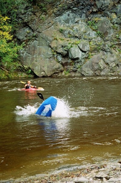
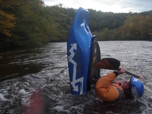
Tower (named for a small railroad tower on the right bank - also called Snaggletooth) is the best the Lehigh has to offer. A long technical rapid with a lot of rocks and waves, it just gets better with more water. Not a place to be out of your boat, though. From Iron Ring Eddy head immediately to the center of the river (or better yet, skip the eddy) to avoid a set of pinning rocks on the right side. Cut back right, behind the rocks and pick your way down to a river wide rocky ledge/drop. Run it through slots on far right or in the center. Once past the ledge, enjoy the bouncy waves until it mellows out a little. Then you will see Battleship Rock slightly to the right of the current. At under 1000 cfs, it is the worst (or best) pinning spot on the river (my personal record is 3 rafts wrapped one on top of each other). Go left of the rock, and down through some small holes and rocks. After this stretch you can relax, all thats left are some easy drops.
Just across from the takeout at Glen Onoko, the river makes a sweeping right hand turn. The current piles up against a steep rock cliff, and the rafts pile up against a knob sticking out of the cliff. If two rafts get stuck at the same time, the second usually flips - providing a lot of amusement for spectators. If you are continuing downstream, watch out for the bridge piers at high water. Otherwise, you can get some squirts off the eddy line there. Glen Onoko has become a popular place, with a lot of bicyclists along the old railroad bed and hikers going up to the falls. This section of the river down to Jim Thorpe can be run down to 250 cfs, if you don't mind a short day on the river. Glen Onoko can be reached by car from the east side of Jim Thorpe - take Main Street north until you see tha park entrance sign. Parking, restroom, and change facilities are available thanks to the park service.
Take Out. Can continue downstream 2.7 miles and take out in the town of Jim Thorpe's parking lot on the river side of the railroad tracks.
Aug 29, 2016
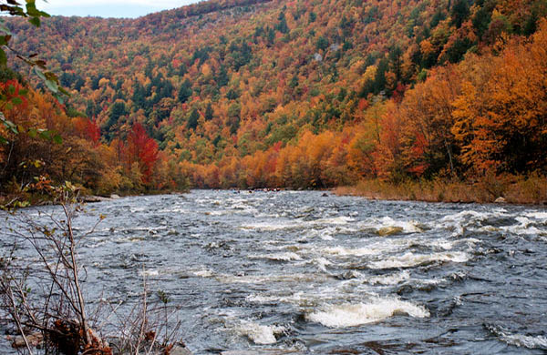
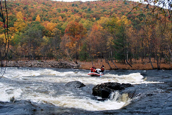
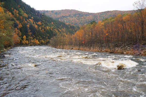
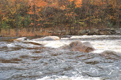
Lower Lehigh River, Entrance Rapid
Jun 2, 2016
A detailed description of the entire Lehigh River can be found in the 'Lehigh River Paddling Guide,' which can be purchased online at http://www.ggentile.com/nonfiction\_books.html. Scroll down to the appropriate title.
Apr 15, 2016
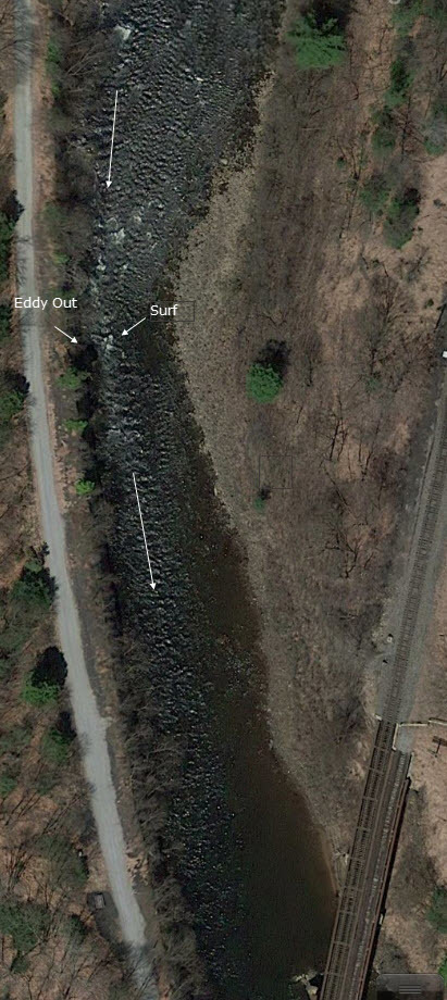
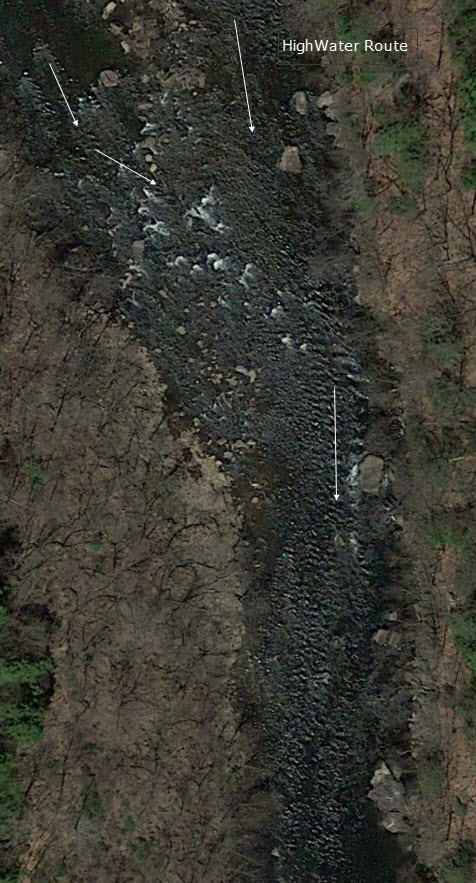
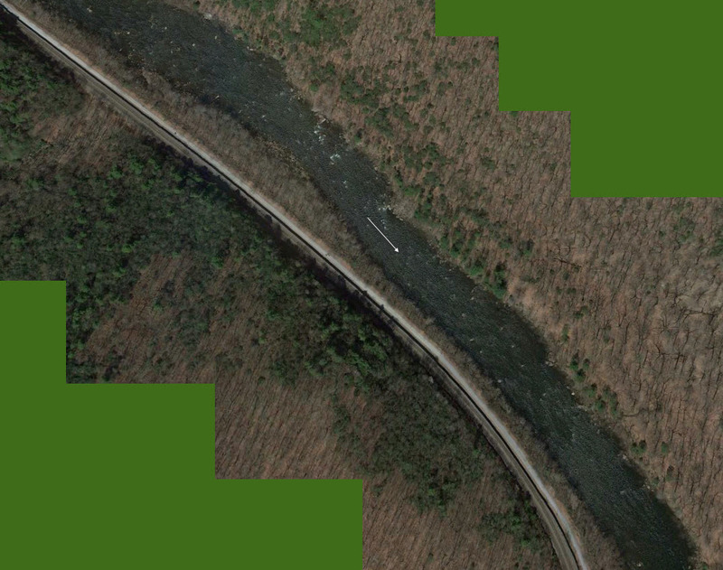
Satellite photos taken April, 2016. With brief comments