Guess Creek
State Highway 146 to County Road 20
| Difficulty | III-IV+ |
| Length | 8.6 mi |
| Avg Gradient | 100 fpm |
| Reach Info Last Updated | January 4, 2017 |
Beautiful creek set in the most remote wild area of Alabama, The Paint Rock Valley. Unfortunatly like many Cumberland Plateau Creeks it flows above and below the stream bed.
We observed good flow at the take out at Blue Springs [250 cfs]
and good flow at the put in. But the entire flow disappeared at the first good box canyon leaving us hiking down a bone dry creek bed. After a day of hiking dry stretches interspaced with some sections with decent water we made it to the bottom where we observed the entire flow emerging out of Blue Spring.
A very beautiful run but it would need to be flooded to make up for all the water going underground.
Latitude/longitude coordinates not assured.
Jan 4, 2017
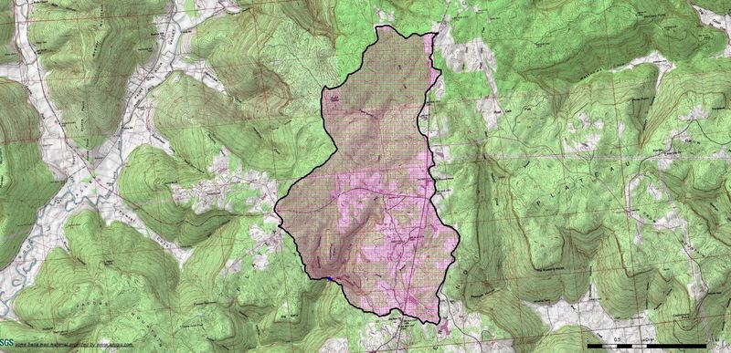
This is what the drainage basin looks like after the main tributaries have all joined. Mill starts at Sanders Cemetary on Hwy 146 and has a 3.9 square mile drainage area at this point. Neely Branch, from river left, adds 3.6 square miles of drainage area. Guess Creek, from river right, adds ~1.6 square miles of drainage area. The total basin size at this confluence is 9.1 square miles.
Jan 4, 2017
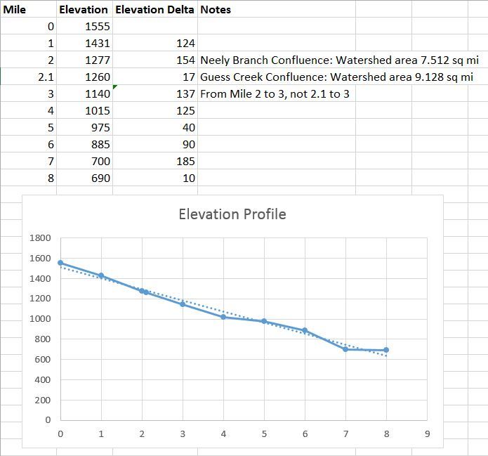
Elevation profile and gradient notes. Average gradient = 108 ft/mile. Steepest mile = mile 1-2 @ 157 ft/mile.
Jan 4, 2017
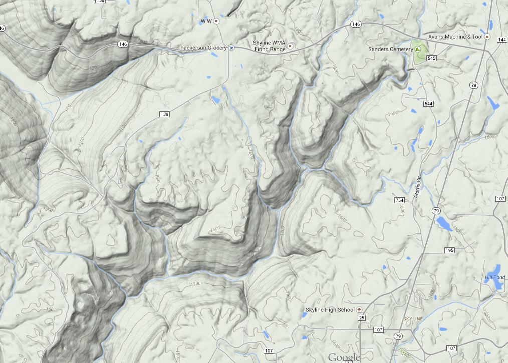
This creek starts off named 'Mill Creek', at the sensible put in on Hwy 146 at Sanders Cemetery. In this picture, you see the two main forks that start near each other on Hwy 146. The left/west fork is Guess, the right/east fork is Mill. At Hwy 146, Mill has a drainage area of 3.9 square miles. At Hwy 146, Guess as a drainage area of ~1.5 square miles.