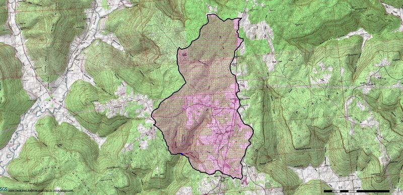
Guess Creek
State Highway 146 to County Road 20
Jan 4, 2017
This is what the drainage basin looks like after the main tributaries have all joined. Mill starts at Sanders Cemetary on Hwy 146 and has a 3.9 square mile drainage area at this point. Neely Branch, from river left, adds 3.6 square miles of drainage area. Guess Creek, from river right, adds ~1.6 square miles of drainage area. The total basin size at this confluence is 9.1 square miles.
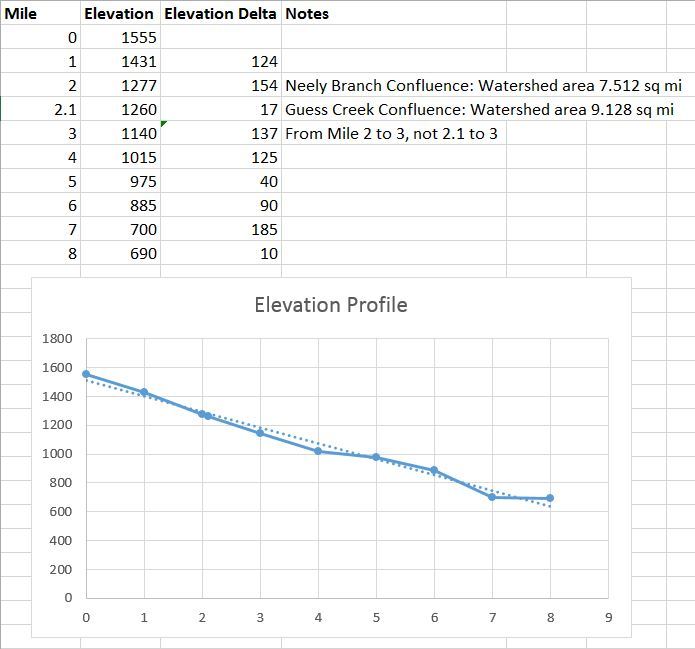
Jan 4, 2017
Elevation profile and gradient notes. Average gradient = 108 ft/mile. Steepest mile = mile 1-2 @ 157 ft/mile.
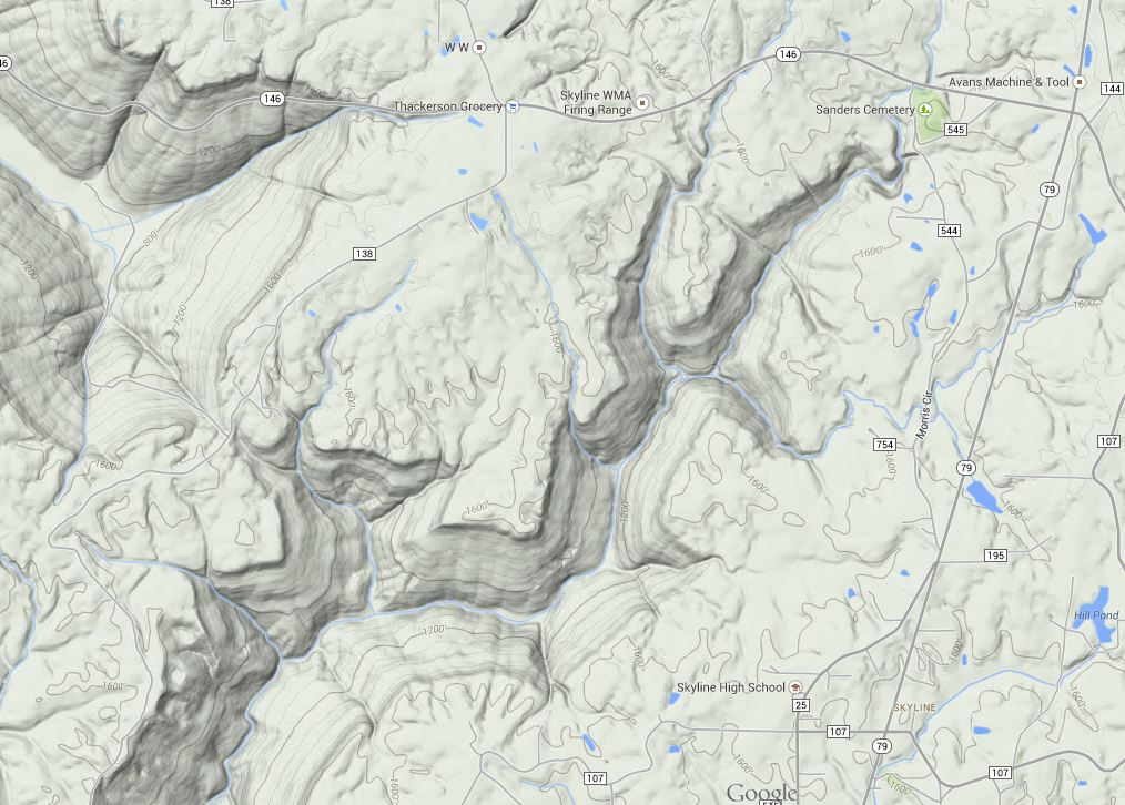
Jan 4, 2017
This creek starts off named 'Mill Creek', at the sensible put in on Hwy 146 at Sanders Cemetery. In this picture, you see the two main forks that start near each other on Hwy 146. The left/west fork is Guess, the right/east fork is Mill. At Hwy 146, Mill has a drainage area of 3.9 square miles. At Hwy 146, Guess as a drainage area of ~1.5 square miles.