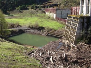
Milltown Dam Breached!
On Friday, March 28th, hundreds of people gathered to watch the breaching of Milltown Dam just upstream of Missoula, MT. The dam had impounded the confluence of the Blackfoot and Clark Fork rivers for a century. During that time the dam trapped mining waste from upstream that contained toxic chemicals like arsenic. The pressure of the reservoir drove arsenic into nearby wells, and to top it all off the dam was deemed a high risk for failure. Based on nearly